Rethymno Old Town: A Walk Through Two Empires
What should you actually look for in Rethymno's old town?
Look for two empires stacked on the same street plan: Venetian doorways, loggias and fountains built between 1204 and 1669, overlaid with Ottoman minarets, wooden kiosks and fountains added after 1669. The Fortezza, the Rimondi fountain and the harbour lighthouse anchor a town that has no fixed route, and that stays open and lived-in all year, unlike the resort coast to the south.
Two empires, one street plan
Most visitors arrive in Rethymno’s old town expecting a postcard: pastel shutters, a harbour lined with fish tavernas, maybe a mosque for scale. What they get, if they slow down, is something more interesting than a backdrop. It is a working town where two empires built on top of each other without ever fully erasing what came before, and the lanes still read like a document if you know what you’re looking at.
Venetian rule over Crete ran from 1204, after the Fourth Crusade carved up Byzantine territory, to 1669, when the long siege of Candia finally fell to the Ottomans. Rethymno itself, less fortified and less strategically vital than Candia (today’s Heraklion), was taken earlier, in 1646.
That gap matters: it means the Ottoman layer in Rethymno has had over two centuries longer to settle into the fabric of the town than it did in Heraklion, and the result is a denser, more genuine overlap of the two periods rather than one style stamped flat over the other. Ottoman administration lasted until 1898, when Crete became an autonomous state ahead of union with Greece in 1913. Walk the old town with that timeline in your head and the doorways stop being decoration and start being evidence.
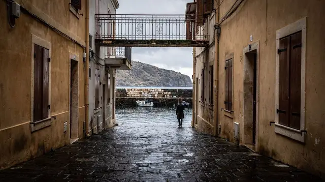
This is not a walk with a start point, a finish line, or a printed map that makes sense of every turn. The old town is a genuine, lived-in neighbourhood of maybe a few thousand people, not a museum set dressed for tourists, and the honest way to see it is to lose the thread on purpose and let the street plan itself explain the history.
Reading the Venetian layer
Venetian Rethymno left its clearest mark in stone. Look for doorways set into plain house fronts, cut from a paler stone than the walls around them, often carrying a coat of arms or a Latin inscription worn down to a few legible letters. These belonged to Venetian merchant families, and a surprising number survive, reused as private house entrances that locals still walk through every day.
The clearest civic example is the Rimondi fountain, built in 1626 by the Venetian governor Alvise Rimondi: a stone loggia with three spouting lion heads and Corinthian columns, fed by a spring channelled down from the hills. It still runs. Nearby, the Venetian loggia, a rectangular arcaded hall once used as a gentlemen’s meeting place for the city’s Venetian nobility, has been restored and now functions as a small archaeological collection point rather than a ruin behind a fence.
Then there is the Fortezza, the fortress that dominates the headland above the old town. Rethymno’s Venetian defences were notoriously weak before 1573, which is exactly why the city fell so early to the Ottomans in 1646 relative to the rest of the island — the fortress was built too late and finished too thin to hold. Walking its walls today gives the best single vantage point over the roof tiles, minarets and satellite dishes of the old town below, and the contrast between the fortress’s scale and its actual military failure is its own kind of history lesson. The full logic of the site, and why it fell when better-defended Candia held for twenty-one more years, is covered in the Fortezza guide.
Reading the Ottoman layer
The Ottoman period is easier to spot and harder to read correctly, because its most visible feature — minarets — often sit on buildings that were originally something else. Several of Rethymno’s minarets were grafted onto existing Venetian churches rather than built from scratch, a fast way to convert a captured city’s religious architecture. The Neratze mosque, formerly the Venetian church of Santa Maria, keeps its Venetian bell-tower base under an Ottoman minaret and now serves as a concert hall — look at where the stonework changes colour and texture partway up the tower.
Domestic Ottoman architecture shows in a different register: wooden upper floors called sachnisia, jutting out over the lane on carved brackets to gain floor space without widening the street at ground level. They give the old town’s narrowest lanes their tunnel-like, shaded feel, and they are a genuinely Ottoman contribution — Venetian building in Crete stayed almost entirely in stone.
Fountains are a useful marker too. Venetian fountains, like Rimondi’s, tend to be rectangular and classical, with columns and pediments borrowed from mainland Italian models. Ottoman-era fountains, by contrast, run to octagonal or domed forms with calligraphic inscriptions, several of them tucked into corners rather than placed as a civic centrepiece. Finding both types within a few streets of each other is the fastest way to feel the two periods sitting on top of one another rather than reading them as separate chapters in a guidebook.
For the wider political and military story behind these two layers — the 1204 to 1669 Venetian period, the fall of Candia after a twenty-one-year siege, and what actually changed under Ottoman rule — the Venetian Crete guide fills in what a walk alone can’t.
The harbour, the market, and where the town actually lives
Rethymno’s small Venetian harbour, guarded by a slim white lighthouse usually dated to the Ottoman period despite its Venetian-looking base, is the most photographed corner of the old town and also the most obviously geared toward visitors — expect a wall of near-identical fish tavernas along the quay. It’s worth a look for the lighthouse and the fishing boats, but it is not where Rethymno’s daily life happens.
That’s a street back, on Ethnikis Antistaseos, the old market street that runs roughly north to south through the centre. This is where the sachnisia overhang is at its most dramatic, where small workshops still sell leather, olive wood and local food rather than beach towels, and where you’ll pass actual Rethymniots doing errands rather than only other travellers. Side lanes off this street are where the coats of arms and the odd carved date stone tend to turn up, precisely because nobody has cleaned them up for a tour route.
If food is part of how you want to explore, a guided walk built around tastings covers more ground with context attached: a Rethymno old town food tasting tour moves between small producers and family-run spots that a solo visitor would likely walk past without knowing what to look for, and a craft beer walk through the old town does the same thing for the town’s small but growing brewing scene, threading between the same Venetian and Ottoman streets on the way between stops.
Walking it with someone who reads the layers
None of this history is signposted in detail on the street itself — there are a handful of information panels, but most of the layering described above is legible only if you already know roughly what you’re looking for, or if someone points it out as you walk. A guided walking tour of the old town solves that in about two hours, moving between the Rimondi fountain, the loggia, the Neratze mosque and a handful of the better-preserved doorways, with the Venetian-to- Ottoman handover explained as you go rather than reconstructed afterward from a guidebook.
For a slower, more visual version of the same idea, timed for the light rather than the history lecture, an evening history and photo walk through the old town covers similar ground at golden hour, when the stone façades and the harbour lighthouse photograph best and the day-trip crowds have mostly cleared out. A cultural walking tour with a bookmark-making workshop adds a hands-on stop that works well if children are along and two hours of architecture alone would be a hard sell.
A capital that stays open, and the hinterland behind it
It matters that Rethymno is a regional capital, the second city of its region after Chania, and not a seasonal resort. Along the south coast and around the package strip east of Heraklion, plenty of hotels, restaurants and even whole small resorts close for winter, sometimes as early as late October. Rethymno doesn’t, because it doesn’t depend only on beach tourism to function — it’s a university town and a working port as well as a destination, and the old town’s shops, bakeries and tavernas stay open through the low season, just on shorter hours.
A winter visit here is a genuinely different, quieter version of the same walk, not a closed-up off-season ghost town. What actually shuts down island-wide by month is covered in the Crete weather month by month guide, and the broader case for visiting outside July and August is in when to visit Crete.
It also runs, like the rest of the island, on Eastern European Time — UTC+2 in winter, UTC+3 in summer — which is one hour ahead of Paris, Berlin and Rome regardless of the season. If a shop’s posted hours look odd against your phone’s home-city clock, that’s usually why.
Rethymno’s old town is also the natural base for two inland sights that belong to its hinterland rather than to Heraklion or Chania. Arkadi monastery, about 25 minutes by car into the hills, is where the 1866 siege ended with the defenders blowing up their own powder magazine rather than surrender — a working monastery today, and a genuine national symbol rather than a stop added for the sake of an itinerary; the full story is in the Arkadi monastery guide, and the village itself sits at Arkadi.
A little further into the foothills of Psiloritis, the pottery village of Margarites keeps a tradition of wheel-thrown ceramics that predates the Venetians entirely; see the pottery and crafts guide and the Margarites and Melidoni destination page for what’s actually worth buying there rather than mass-produced souvenirs made elsewhere.
Table: what to look for, layer by layer
| Feature | Venetian (1204-1669) | Ottoman (1646/1669-1898) |
|---|---|---|
| Doorways | Carved stone, coats of arms, Latin inscriptions | Reused Venetian doorways, plain timber doors added later |
| Upper floors | Flush stone façades | Wooden sachnisia jutting over the lane |
| Fountains | Rectangular, classical columns (Rimondi, 1626) | Octagonal or domed, calligraphic inscriptions |
| Religious buildings | Churches with bell towers | Minarets grafted onto former churches (Neratze) |
| Fortification | The Fortezza, built too late to hold in 1646 | Ottoman-era repairs and additions inside the walls |
Practical notes for walking without a plan
There is no single correct route through Rethymno’s old town, and treating it as a checklist misses the point of a street plan built by two empires who never quite agreed on how a town should be laid out. A rough anchor helps more than a fixed itinerary: start near the harbour lighthouse, work inland past the Rimondi fountain and the loggia, let the market street pull you north to south, and finish at the Fortezza in the late afternoon when the light and the temperature both favour the climb.
Comfortable shoes matter more than in most Cretan old towns — the lanes are cobbled and some stretches around the Fortezza are stepped or uneven. Summer heat builds fast in the narrower, shadeless approach to the fortress, so an early morning or an early evening visit beats midday. The old town has no shortage of places to stop, but the harbour-front tavernas are priced for the view rather than the food; a street or two back, on and off Ethnikis Antistaseos, is where locals actually eat.
Rethymno pairs naturally with the rest of the region rather than standing alone. A two-day base here covers the old town properly with a day left for Arkadi and Margarites — see Rethymno in two days — and it slots into a longer route through Chania’s old town to the west and Heraklion’s city centre to the east; the west-to-east itinerary uses Rethymno as exactly this kind of hinge. For how the three old towns actually differ in character and pace, Chania versus Rethymno versus Heraklion is worth reading before deciding where to sleep.
Most visitors arrive by rented car, which is the practical default for reaching Arkadi and Margarites afterward — see renting a car in Crete — though the coastal KTEL coach network also runs Rethymno into the north-coast route between Chania and Heraklion; details are in the KTEL buses guide. Either way, once you’re inside the old town itself, the only vehicle that matters is your own two feet, on streets that were never designed with cars in mind by either of the empires that built them.
Frequently asked questions about walking Rethymno’s old town
How long does it take to walk Rethymno’s old town?
A slow loop past the main landmarks takes about two hours. Most visitors give it half a day, since the point is to wander the side lanes without a fixed route, and a full day if the Fortezza and a harbour meal are added.
Is Rethymno’s old town open all year?
Yes. Unlike the beach resorts of the south coast, which largely shut down from November to March, Rethymno is a working regional capital with tavernas, shops and the Fortezza open through the winter, though hours run shorter.
What is the difference between the Venetian and Ottoman layers?
The Venetian layer, built between 1204 and 1669, shows in stone doorways with coats of arms, arcaded loggias and rectangular fountains. The Ottoman layer, added after the 1646 conquest and lasting to 1898, shows in wooden overhanging balconies called sachnisia, minarets grafted onto former churches, and octagonal or domed fountains.
Do I need a guide to understand what I’m seeing?
No, but a guide helps you notice details that are easy to walk past, such as a Venetian coat of arms reused as an Ottoman doorstep. A two-hour guided walk is enough to read the street plan for the rest of your stay.
What time zone does Rethymno keep?
Eastern European Time, UTC+2 in winter and UTC+3 in summer, which is one hour ahead of Paris, Berlin and Rome year-round. Opening hours posted locally follow this time, not central European time.
Is Rethymno old town walkable with limited mobility?
The harbour front and the main market street are flat and paved, but the residential lanes behind them are cobbled, narrow and occasionally stepped, and the Fortezza involves an uphill approach and uneven ground inside.
What’s nearby if I want to see more of the region?
Arkadi monastery is about 25 minutes inland, and the pottery village of Margarites sits a little further into the foothills of Psiloritis, making an easy half-day loop from the old town.
Where should I stay to explore Rethymno on foot?
A room inside or on the edge of the old town, within the Venetian walls or along the harbour, puts every landmark within a ten-minute walk and lets you return after the day-trip buses have left.
City Walking Tours in Crete on GetYourGuide
Verified deep-linked GetYourGuide tours. Book through these links and we earn a small commission at no cost to you.
GetYourGuide does not provide a product photo for this activity — the image shows the meeting point, photographed by us.