Why Crete needs a plan before it needs a hotel
Crete is often sold as one line on a map of the Greek islands, next to Santorini and Mykonos. It behaves nothing like them. At 8,336 km², it is the largest island in Greece and the fifth largest in the Mediterranean: roughly 260 km from the Venetian harbour at Chania in the west to the palm beach at Sitia and Vai in the east, but only 12 to 60 km from the north coast to the Libyan Sea in the south. Around 620,000 people live here, spread across four regional units that run west to east — Chania, Rethymno, Heraklion, Lasithi — each with its own capital, its own mountains, and its own version of what a “Crete holiday” looks like.
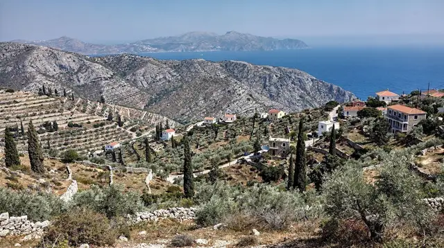
That shape is the first thing worth understanding, because it decides everything else about how a trip here gets planned. A narrow, elongated island with real mountains down its spine (Psiloritis at 2,456 m, Pachnes at 2,453 m in the Lefka Ori) does not compress into a single loop the way a round island does. Driving from one end to the other is not a scenic afternoon; it is the better part of a working day. This page exists to set that expectation before anyone picks a base, because the single most common mistake in Crete trip planning is booking a hotel first and discovering the geography afterwards.
The four regions, west to east
Each regional unit has a distinct character, and most visitors end up seeing two or three of them, not all four in one trip unless they have two weeks.
| Region (regional unit) | Main town | Character | Signature stops |
|---|---|---|---|
| Chania | Chania town | Venetian harbour, wild west coast | Balos and Gramvousa, Elafonissi, Falassarna |
| Rethymno | Rethymno town | Old town plus mountain villages | Samaria gorge, Arkadi monastery, Anogia |
| Heraklion | Heraklion city | The capital, Minoan sites, wine country | Knossos, Archanes and Dafnes, Matala |
| Lasithi | Agios Nikolaos | Quieter, easternmost, fewer crowds | Lasithi plateau, Spinalonga, Sitia and Vai |
The western regions, Chania and Rethymno, hold the mountains and gorges most visitors picture: the Samaria gorge running 16 km one-way from the Xyloskalo at Omalos down to Agia Roumeli, a village with no road out except by boat, and the White Mountains rising directly behind the coast. Heraklion, the centre, holds the archaeology — Knossos and the wine villages around Archanes and Peza — and is also the most convenient landing point for a first-time visitor, since its airport has the widest range of flights. Lasithi, the east, is the quietest of the four: the Lasithi plateau at around 850 m, the Dikteon cave, and Agios Nikolaos on the gulf of Mirabello, with Spinalonga a short boat ride offshore.
A route that tries to string all four together in under a week ends up spending more time driving than seeing anything. For a first trip, picking two adjacent regions and planning a genuine loop through each works far better than a thin smear across the whole island. Our how many days in Crete guide breaks this down by trip length, and where to stay in Crete matches each region to the kind of trip it suits.
How long you actually need
There is no single right answer, but there is a floor. A week is the minimum to do one or two regions justice without spending every second day in the car. Ten to fourteen days is what it takes to genuinely cross the island, from the western beaches to the Lasithi plateau, with room for a gorge hike, an island boat trip and a full day given over to ruins and museums rather than driving between them.
| Trip length | Realistic scope |
|---|---|
| 3-4 days | One region only — usually Chania or Heraklion |
| 7 days | Two adjacent regions, one loop |
| 10 days | Three regions, west to centre or centre to east |
| 14 days | The full island, west to east, at a relaxed pace |
If the plan is to see Knossos, hike Samaria and lie on a beach at Elafonissi in the same four-day trip, something has to give — those three points alone form a triangle that takes a full day of driving to connect. Our 7-day west-to-east itinerary and 10-day full-island itinerary are built around this constraint rather than around a wish list, and the 3-day west option shows what a single-region trip looks like when the flight only allows a long weekend.
Landing here: three airports, and one that is not open yet
Crete has three working airports, and knowing which one to fly into is a planning decision in its own right, not a formality.
Heraklion (HER), just east of the capital, has by far the widest range of international connections and suits a route that starts in the centre or east — Knossos, the wine villages, Lasithi and Agios Nikolaos are all within an hour or two. Chania (CHQ), at Souda east of the city, is the better landing point for a route that starts in the west — the Samaria gorge, Balos and the Akrotiri peninsula are all close from here. Sitia (JSH), in the far east, is small, with limited seasonal connections, and mainly useful for a trip that both starts and ends in Lasithi.
A fourth airport, Kastelli, is planned to eventually replace Heraklion’s, but it is still under construction and has no scheduled flights. Nothing about a current trip to Crete should assume it exists yet. See our Heraklion airport guide and Chania airport guide for arrival logistics, or ferries from Piraeus to Crete for the overnight boat option, which also runs to Heraklion and to Chania at Souda in around nine hours.
Many trips also fly into one airport and out of the other — landing in Chania and departing from Heraklion, for instance — which avoids doubling back and suits the island’s elongated shape better than a round trip through a single gateway.
a full-day Land Rover route through the west’s back roads and coastal villages is one way to cover ground fast on a short trip without doing all the driving yourself.
Getting around once you land
A rental car is the practical default for almost every itinerary in Crete, and it is worth booking before arrival in July and August. The KTEL coach network is genuinely usable along the north coast — Chania, Rethymno, Heraklion and Agios Nikolaos are linked by frequent buses on the VOAK/E75 highway — but south of the mountains, toward Sfakia, Plakias or Ierapetra, it thins out to a few seasonal, once- or twice-a-day runs.
There is no train anywhere on the island, and despite snow on Psiloritis and the White Mountains into May or June, there is no ski lift either. Our renting a car in Crete and driving in Crete guides cover insurance, unpaved-road exclusions and mountain-road etiquette; KTEL buses in Crete covers the routes that do work well without a car, and crete without a car is a full itinerary built around them.
For the west’s dirt-road detours specifically — the track down to Balos, for one, which most rental contracts exclude from cover — an organised trip removes the insurance question entirely.
a boat day from Kissamos to the Balos lagoon and the fortress islet of Imeri Gramvousa reaches both without putting a rental car on unpaved ground.
What Crete is not
Three assumptions trip up first-time visitors before they even land, and each one changes how a route should be built.
It is not a volcanic island. There is no caldera, no fumarole, no thermal bathing pool and no lava field anywhere on Crete. The island is limestone and folded mountain rock, cut by gorges rather than built by an eruption — Samaria and Imbros are the results of millions of years of water finding a way through that rock, not a crater. Travellers picturing black-sand beaches and a caldera view are thinking of Santorini, reachable from Crete by seasonal day boat or a short flight; see Crete vs Santorini if that comparison is part of the decision.
It is not small. The distance from Chania to Sitia is about 270 km and takes over four hours by road, more with stops. A single hotel cannot be a sensible base for a trip that wants to see the far west and the far east; the island’s own length rules that out before any itinerary is drawn up.
It is not one long resort strip. The organised package coast between Gouves and Malia — Gouves and Hersonissos, Stalida and Malia — runs roughly 20 km. Set against a 260 km island, that is a narrow band; the other 92 percent is Venetian old towns, mountain villages, working wine estates, remote gorges and beaches with no all-inclusive hotel anywhere nearby.
A visitor who only sees the strip has seen a fraction of what the island actually is. Our Hersonissos vs Malia vs Stalida guide is useful for anyone who does want that specific kind of holiday, and north coast vs south coast Crete covers the quieter alternative on the Libyan Sea side.
Putting a first route together
A sensible way to start is to pick the region that matches the trip’s real priority, then build outward from there rather than trying to touch all four. A hiking-and-gorge trip anchors on Chania or Rethymno, close to Samaria and the White Mountains. An archaeology-and-wine trip anchors on Heraklion, close to Knossos and Archanes. A slower, quieter trip anchors on Lasithi, close to the Lasithi plateau and Spinalonga.
a guided day hiking the full 16 km of the Samaria gorge, with the boat and coach transfer out included is the west’s single most-booked full day, and worth building an itinerary around rather than adding as an afterthought — the park’s limited opening season (roughly May to October) and early-afternoon gate closures mean it needs a fixed day on the calendar.
For a centre-based trip, Knossos and the Lasithi plateau pair naturally as a single inland day away from the coast.
a day combining the Minoan palace at Knossos with the mountain villages of the Lasithi plateau covers both without needing a rental car for that stretch, and a similar day from the south coast reaches Phaistos and Matala instead — see our Phaistos and Gortyna guide for the ancient-sites detail.
Once a region is chosen, our where to stay in Crete and Chania vs Rethymno vs Heraklion guides help settle the actual town, and the mistakes to avoid in Crete page collects the planning errors — mostly underestimating distances — that come up most often.
When to go
May through October is the working season for most of the island’s infrastructure. July and August are the hottest months, with temperatures of 30-35°C and higher in a heatwave, and the meltemi, a strong north wind, blows through those two months, regularly cancelling boat trips to Balos, Gramvousa and Chrissi while leaving the calmer south coast largely unaffected. Late April to June and September to mid-October are the best balance for most travellers: the Samaria gorge is open, the sea runs 21-25°C by June and 24-27°C in September, and the crowds thin noticeably.
November to March is a genuine low season — the coast stays mild at 12-18°C, the mountains hold snow, the Samaria gorge closes, boat trips barely run, and many south-coast and resort businesses shut for the winter, though the old towns of Chania, Rethymno and Heraklion, along with Knossos and the museums, stay open year-round. See best time to visit Crete and Crete weather month by month for the full seasonal detail.
Frequently asked questions about planning a trip to Crete
How many days do you need in Crete?
Seven days is the practical minimum for two of the four regions without rushing. Ten to fourteen days lets you cross from Chania to Lasithi at a comfortable pace, with time for a gorge hike, a boat trip and at least one full day of ruins and museums.
Is Crete better as one base or several?
Several. The island is about 260 km long, and Chania to Sitia is over four hours of driving. Most itineraries work best as a loop with two or three bases, spending two to four nights in each rather than day-tripping the whole island from one hotel.
Do I need a car in Crete?
For most itineraries, yes. The KTEL coach network genuinely works along the north coast between Chania, Rethymno, Heraklion and Agios Nikolaos, but it thins to a handful of seasonal runs south of the mountains, and there is no train anywhere on the island.
Which airport should I fly into, Heraklion or Chania?
Heraklion (HER) suits a route that starts in the centre or east, near Knossos and Agios Nikolaos. Chania (CHQ) suits a route that starts in the west, near the Samaria gorge and Balos. Both have far more international connections than the small Sitia airport (JSH).
Can I fly into Kastelli airport?
Not yet. Kastelli, the new airport planned to replace Heraklion’s, is still under construction and has no scheduled flights. Every current route into Crete uses Heraklion, Chania or Sitia.
Is Crete a volcanic island like Santorini?
No. Crete has no caldera, no fumaroles and no volcanic hot springs; it is limestone and folded mountain rock, cut by deep gorges such as Samaria and Imbros. Travellers looking for volcanic scenery are thinking of Santorini, which is reachable from Crete by seasonal boat or a short flight.
How far is it from Chania to Sitia?
About 270 km and over four hours of driving along the north coast, longer with stops. It is the clearest evidence that Crete cannot be treated as a single day-trippable destination from one hotel.
Is the Hersonissos-Malia strip typical of the whole island?
No. The organised resort coast between Gouves and Malia runs roughly 20 km of a 260 km island. The other 92 percent is old harbour towns, mountain villages, gorges and beaches with no package infrastructure at all.