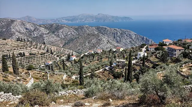
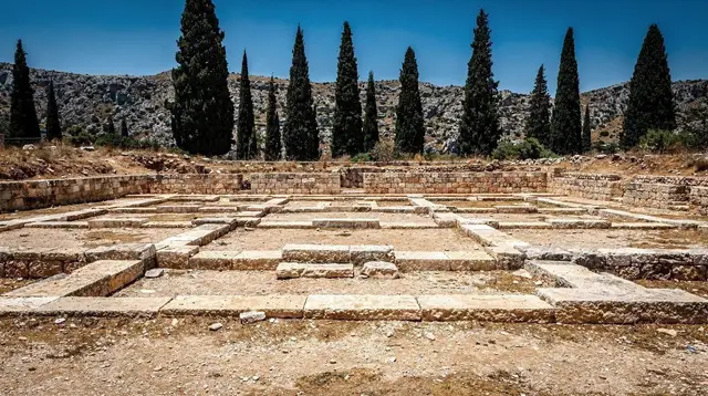
A mountain village, not a mountain resort
Anogia is not on the way to anywhere. It sits at around 740 m on the northern shoulder of Psiloritis, reached by a spur road off the main Rethymno-Heraklion route, and its whole reason for being there — long before tourism existed on Crete at all — is the mountain above it. Sheep, not sunbeds, built this village.
If you are looking for a beach base with a mountain day-trip attached, Anogia will disappoint you; there is no beach here, no strip of souvenir shops competing for your attention, and no promise that a summit is a casual outing. What Anogia offers instead is the shortest, most logical route onto the roof of Crete: Psiloritis, also known as Mount Ida, the island’s highest point at 2,456 m, whose upper slopes hold snow into May or, in a heavy year, June.
That combination — genuine mountain culture plus the practical last stop before the high ground — is the honest case for coming here. It is also worth saying plainly what Anogia is not. It is not a resort with lifts, marked family trails and a café at the top. There is no chairlift, no cable car and no ski infrastructure of any kind anywhere on Psiloritis, or anywhere else in Crete, despite the snow that sits on its ridges for half the year. The mountain is climbed on foot, on a track that only partly qualifies as a maintained path, and the village below it has the infrastructure of a working Cretan community rather than a purpose-built gateway town.
Why Anogia is the logical start for Psiloritis
Psiloritis can technically be approached from several directions — from the Amari valley to the south, from Zaros, from the Nida plateau road that Anogia itself feeds. In practice, Anogia wins for three reasons. First, distance: the paved road from the village climbs about 25 km up through pine forest to the Nida plateau, the highest drivable point on this side of the range, cutting a large share of the elevation gain before a boot ever touches the trail.
Second, services: Anogia has fuel, a handful of tavernas, rooms and a functioning main street, which none of the alternative approach villages can match in the same concentration. Third, culture: this is the village that has, for generations, sent its shepherds up onto Psiloritis with the flocks each summer, and that lived history still shapes how the mountain is used and talked about here — not as scenery, but as pasture.
None of that changes what the mountain itself demands. From the Nida plateau to the summit is still a genuine high-altitude hike of several hours each way over rock and scree, gaining over 800 m of elevation from the trailhead alone. Anogia shortens the approach; it does not shorten the climb.
Getting to Anogia: no KTEL, and narrow roads with a local rule
Crete’s coach network, the KTEL, is genuinely useful along the north coast corridor — Chania to Rethymno to Heraklion to Agios Nikolaos — where buses run frequently on the main highway. Anogia sits outside that logic entirely. There is no scheduled coach service reaching the village on any kind of useful timetable, and there is certainly no public transport climbing the mountain road beyond it. A rental car is not a convenience for reaching Anogia and Psiloritis; it is the only realistic way to get there, and driving in Crete on roads like this one is a different skill from cruising the coastal highway.
The road up from the Rethymno-Heraklion route narrows steadily, switchbacking through villages and then open hillside, and above Anogia it narrows further still on the way to the Nida plateau. These are not roads built for two cars to pass at speed. The local custom, and a genuinely useful one to know before you drive it, is that a slower car pulls onto the hard shoulder to let a faster one overtake — a courtesy, not an invitation to overtake blind on a bend.
Expect gravel at the road’s edge, occasional loose stone on the tarmac itself, sheep or goats crossing without warning, and — outside summer — the chance of snow or ice on the highest stretch. None of this is unusual for a Cretan mountain road, but it is worth taking seriously precisely because Anogia’s approach feels, for its first few kilometres, like an ordinary village road before it becomes something else.
| Route | Distance | Road character |
|---|---|---|
| Rethymno to Anogia | 37 km | Main road, then a climbing secondary road |
| Heraklion to Anogia | 65 km | Main road, then the same climbing spur |
| Anogia to Nida plateau | 25 km | Narrow, forested, switchbacks, no barrier on some bends |
| Nida plateau to Psiloritis summit | On foot | Marked in places, rocky, exposed above the treeline |
For travellers who would rather not drive the mountain section themselves, a guided option removes that decision without removing the mountain: a private 4x4 trip up through Anogia to the Psiloritis chalet on the Nida plateau covers the same climbing road with a driver who takes it every week.
The road to the Nida plateau and the Toubotos Prinos refuge
Above Anogia, the road climbs through pine and cypress forest into open, stony highland — the Nida plateau, a bowl of high pasture at roughly 1,400 m that has been grazed by Anogia’s shepherds for centuries and is dotted with the stone mitata, the round shepherd huts where Cretan cheese has traditionally been made. This is also the access point for the Ideon Andron cave, one of the caves competing in mythology for the birthplace of Zeus, alongside the better-known Dikteon cave on the Lasithi plateau to the east — the two are often confused by first-time visitors, and it is worth knowing they are different sites in different mountain ranges.
From the plateau’s edge, a mountain hut known as the Toubotos Prinos refuge marks the effective start of the summit trail. Beyond it there is no facility of any kind: no shop, no water point that can be relied on, no signal for much of the route, and no rescue infrastructure beyond what a hiker carries and plans for. This is the honest state of Psiloritis as an outdoor destination — a real mountain in a Mediterranean setting, run on the same self-sufficiency as any serious alpine hike, not a managed attraction with a visitor centre at the top.
When to attempt Psiloritis: May to October, snow lingering into June
The workable hiking season on Psiloritis runs from May to October, the same broad window that applies across Crete’s high ground. Outside those months, snow and ice on the upper route make it a winter mountaineering objective, not a hiking one, and the Nida road itself can close after heavy snowfall. Even inside the season, the timing needs more care than a coastal walk would.
Snow can persist on the highest slopes into May, and in a heavy winter into June, turning sections of the upper route into a snow crossing rather than a dry scramble, with the added risk of a snow bridge over rock or a slick patch on a steep pitch. Early-season hikers should check current conditions locally in Anogia before setting out — shepherds and the mountain refuge staff, where reachable, know the state of the snow line far better than a generic forecast does.
July and August bring the most reliable dry conditions but also full midday heat once the sun clears the ridge, with no shade above the treeline; an early start matters here as much as it does at Knossos, for a different reason. September and into October often give the most comfortable combination of stable weather and cooler air, before the first autumn storms move in and the season effectively closes.
| Period | Conditions on Psiloritis | Suitability |
|---|---|---|
| November–April | Snow and ice likely above the treeline, road may close | Not a hiking season |
| May–early June | Snow can still linger on upper slopes | Experienced hikers only, check conditions |
| Late June–August | Dry, hot, no shade above Nida | Early start essential |
| September–October | Cooler, generally stable | Often the best window |
What the climb actually demands
It needs to be said clearly: Psiloritis is not a waymarked trail for every fitness level, and nobody who has actually walked it markets it that way. The ascent from the Nida plateau gains well over 800 m over rocky, uneven ground with sections of scree and exposed ridge near the top, typically taking most hikers six to eight hours round trip depending on fitness, conditions and how far the road allows a driver to shorten the walk.
Waymarking exists in parts — including stretches shared with the long-distance E4 European trail, which crosses the Psiloritis massif on its route across the island — but it is not continuous or foolproof, and cloud can close in on the summit ridge with little warning even in summer.
What that means in practice: sturdy boots, not trainers; a genuine water supply, since there is nowhere reliable to refill above Nida; a map or GPS track rather than reliance on waymarks alone; sun protection for a route with almost no shade; and a realistic sense of turnaround time, since afternoon cloud and thunderstorms are a real risk on Crete’s high peaks in summer. This is closer in character to the approach demanded on Pachnes and the White Mountains at the island’s other end than to any of Crete’s gorge walks — it rewards mountain hiking experience and punishes the assumption that Greece equals easy walking in sandals.
For visitors who want the mountain’s landscape and culture without committing to the summit push, a guided highland circuit is the sensible middle ground: the 4x4 tour through the Psiloritis foothills, the Sfendoni cave and the mountain villages around Anogia covers the terrain and its context in a single day without requiring a summit attempt.
Anogia itself: cheese, wool, lyra and 1944
Anogia’s identity is inseparable from the mountain and from its own history. The village was burned by German occupying forces in September 1944 in reprisal for its role sheltering resistance fighters and hiding the abducted General Heinrich Kreipe, an episode woven into Crete’s wartime history as directly as the war cemeteries at Souda Bay and Maleme. Rebuilt afterward, Anogia carries that history visibly — in memorials around the village and in how residents speak about it — alongside a living musical tradition that has made it one of the most important centres in Crete for the lyra, the island’s three-stringed bowed instrument, and for the sung couplets known as mantinades.
The village’s practical economy is still built on sheep: wool weaving, and above all cheese, particularly the hard, tangy graviera and the soft whey cheese mizithra, both made from milk brought down from the Nida pastures.
A visit that pairs the mountain with this culture — rather than treating Anogia as a mere car park for the trailhead — is the more honest way to spend time here, and it is the angle a minivan day combining the nearby Sfendoni cave with a hands-on cheese-making stop near Anogia takes, or, for a fuller day among the flocks themselves, a shepherd-for-a-day experience out in the Psiloritis foothills.
Where to base yourself
Anogia works well as an overnight base for anyone planning a genuine summit attempt, since starting from the village or, better, driving up to Nida before dawn shortens an already long day considerably. For visitors who want the mountain as one stop among several, Anogia sits within reach of Rethymno’s old town on the coast, the pottery village of Margarites, and the monastery of Arkadi, all of which can anchor a base with more restaurant choice and easier onward travel than the mountain village itself offers.
| Base | Distance from Anogia | Why choose it |
|---|---|---|
| Anogia village | — | Shortest possible start for a summit attempt |
| Rethymno town | 37 km | Coastal comfort, easy return each evening |
| Heraklion city | 65 km | Airport access, more accommodation choice |
Eating and staying in Anogia
Anogia’s main street holds a genuine cluster of tavernas serving Cretan mountain food — grilled meat, the local cheeses, wild greens, and, inevitably, a free pour of raki at the end of the meal, the grape-marc spirit that has nothing to do with anise or ouzo. Rooms and small guesthouses exist in and around the village, but the choice is modest compared to the coast: this is a working mountain community of a few thousand people, not a resort built to absorb a summer influx. Booking ahead matters more here than it would in Rethymno or Heraklion, and visitors expecting resort-standard hospitality options should recalibrate — Anogia’s appeal is authenticity and proximity to the mountain, not choice of amenities.
Nearby on the same mountain: Sfendoni cave and Zoniana
A short drive from Anogia, the neighbouring village of Zoniana holds the Sfendoni cave, a genuinely well-decorated show cave with stalactites and stalagmites, and a far easier outing than the summit for anyone whose day has room for only one mountain activity. It makes a natural pairing with Anogia itself for travellers who want a taste of the Psiloritis massif without committing to the full climb, and it appears alongside Anogia in several of the things to do around Anogia and Psiloritis worth combining into a single day.
For anyone drawn more to the flowers and slopes of the range than to reaching the summit itself, a guided flower-focused walk through the Rethymno mountain landscape covers similar high ground at a gentler pace, timed to the spring bloom rather than the push to 2,456 m.
Anogia and Mount Psiloritis: practical answers
Is there a chairlift or cable car up Mount Psiloritis?
No. There is no ski lift, cable car or any mechanised way up Psiloritis or any other mountain in Crete, despite snow holding on the summit ridges into May or June most years. The mountain is climbed entirely on foot from the Nida plateau trailhead.
Does the KTEL bus reach Anogia or the Psiloritis trailhead?
No. The KTEL coach network is reliable along the north coast highway between Chania, Rethymno, Heraklion and Agios Nikolaos, but it does not serve Anogia on a useful schedule and does not reach the Nida plateau at all. A rental car, or a private tour, is required.
When is the best time to hike Psiloritis from Anogia?
May to October is the workable window. Late spring can still carry snow on the upper slopes, July and August are hot with no shade above the treeline, and September into October is often the most comfortable stretch, before the season closes with the first autumn storms.
Is the summit path waymarked and suitable for beginners?
Not reliably, and not for beginners. Waymarking exists in stretches, including sections shared with the E4 long-distance trail, but it is not continuous, and the terrain — over 800 m of elevation gain on rock and scree with an exposed upper ridge — demands genuine hiking fitness and mountain judgement, not a casual walk.
How late does snow stay on Psiloritis?
Snow on the summit can persist into May, and in a heavy winter into June, turning parts of the upper route into a snow crossing. Checking current conditions locally in Anogia before setting out is the sensible approach in early season.
Can I drive all the way to the Nida plateau?
Yes, in season. A paved but narrow road climbs about 25 km from Anogia to the Nida plateau at around 1,400 m, where the Toubotos Prinos refuge marks the start of the walking route to the summit. The road can close after heavy snowfall outside the main season.
What should I know about Cretan mountain road etiquette?
On narrow mountain roads like the one above Anogia, a slower car is expected to pull onto the hard shoulder to let a faster one pass. It is a courtesy that keeps traffic moving on roads too narrow for two cars side by side — never an invitation to overtake on a blind bend.
Does Anogia have hotels and restaurants for visitors?
Yes, but on a modest scale. Anogia has a genuine cluster of tavernas and a limited number of rooms and small guesthouses, reflecting its identity as a working mountain village rather than a resort. Booking ahead is worthwhile, especially around a planned summit attempt.