A working town, not a resort
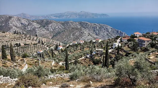
Palaiochora sits at the far south-western edge of the Chania regional unit, on a stubby peninsula that pokes into the Libyan Sea, with a pebble beach on one flank and a sandier one on the other. It has no Venetian old town worth the name, no strip of clubs, and nothing that competes with Chania for architecture or evening atmosphere.
What it has instead is a genuinely useful position: it is one of the towns travellers land in after coming off the Samaria gorge by boat, a base for reaching Sougia and Loutro without backtracking over the mountains, and a place where the sea tends to stay swimmable on days when the north coast is whipped up by wind. That combination — logistics plus a quieter kind of beach holiday — is the honest case for choosing it over a north-coast resort, not the promise of sights to tick off.
Anyone expecting a smaller version of Chania or Rethymno should recalibrate before arriving. Palaiochora is a fishing-and-farming town that grew a tourist layer on top, not the other way round. The pace shows in the fact that most restaurants close by late evening and most visitors here are day-trippers, hikers passing through, or people who deliberately chose a slower few days over a resort itinerary.
Where it sits, and why that matters
The south-west of Crete is a different island from the north coast. Between Palaiochora and Chania or Rethymno stands the Lefka Ori, the White Mountains, whose ridgeline blocks easy east-west travel and forces every road down here into switchbacks. There is no coastal highway equivalent to the VOAK on the north side; instead, the region runs on a mix of mountain roads and boats. Towns like Palaiochora, Sougia, Loutro and Chora Sfakion function as a loose chain along the Libyan Sea, connected to each other more easily by water than by tarmac in several stretches.
This geography is the reason Palaiochora reads as a logistics node as much as a destination. Coming off the Samaria gorge at Agia Roumeli, hikers take a boat out, since the village has no road at all; that boat typically runs toward Chora Sfakion or Sougia, and from either of those, onward travel by coach or a second boat can bring you to Palaiochora within the same day or the next. Travellers doing the shorter, easier walk described in local guides as the “easy Samaria” — a there-and-back stroll from Agia Roumeli rather than the full 16 km descent — follow a similar sea-and-road route home. None of this is instant. Build in a full day for any Samaria-to- Palaiochora connection, and don’t schedule a flight for the same evening.
Getting there — the honest travel times
There is no way to make this section shorter than it needs to be, because the distances here are routinely underestimated by first-time visitors reading a map and assuming Crete’s roads behave like a straight line.
| From | Distance | By car | By KTEL coach |
|---|---|---|---|
| Chania | About 75 km | ~1h15 | ~1.5-2h, several runs a day in season |
| Rethymno | About 95 km | ~2h | Change in Chania, most of a half-day |
| Heraklion | About 150 km | ~2h45-3h | Not practical in one hop |
The road from Chania climbs through the Topolia gorge area and over hill country before dropping to the coast; it is well paved but narrow and bendy for long stretches, the kind of drive where the posted distance tells you little about the time it takes. There is, as with every route on this island, no train — Crete has never had a railway, so a mountain road is always the fastest option, not a fallback. Travellers relying on public transport should check current KTEL timetables before committing to a same-day itinerary, since the network thins out considerably south of the mountains compared with the frequent north-coast line linking Chania, Rethymno and Heraklion.
A Samaria exit point, not the only one
Palaiochora belongs to a small cluster of south-west towns that Samaria gorge hikers pass through or connect via, alongside Sougia, Loutro and Chora Sfakion. The gorge itself runs one-way, 16 km down from the Omalos plateau to Agia Roumeli, a village with no road in or out; everyone who finishes the walk leaves by boat. Where that boat goes, and how the traveller continues from there, is the actual planning question, and Palaiochora is one of several reasonable answers rather than the default one.
For visitors basing themselves in Palaiochora specifically to do the gorge, the practical pattern is an early coach or transfer up to Omalos, the descent to Agia Roumeli, a boat to Chora Sfakion or Sougia, then a connecting bus or boat back. It is a full and tiring day. A guided option removes the timetable-juggling: a guided Samaria gorge hiking day covers transport, park entry logistics and the boat connection as one booking, which matters more here than almost anywhere else on the island, since a missed boat from Agia Roumeli has no quick fix — there is no road to walk out on.
Travellers who want the scenery and the gorge atmosphere without the full 16 km descent can look at the shorter route instead: an easier version of the Samaria gorge walk which starts from Agia Roumeli and turns back rather than continuing the whole way down from Omalos. For a related but separate gorge closer to Chora Sfakion, the Imbros gorge area offers a shorter, steep alternative that some travellers prefer precisely because it avoids the long boat leg:
a guided Imbros gorge walkFor background on how the different south-coast entry and exit points compare, a dedicated guide to reaching Samaria from Chania and the write-up on the easier Agia Roumeli walk both help before locking in a route.
Why the south coast stays calmer
One of the more counter-intuitive facts about Crete’s geography is that its north and south coasts can have genuinely different weather on the same afternoon. The meltemi, a strong wind out of the north that picks up mainly in July and August, drives waves and chop into Chania, Rethymno and the north-coast beaches, and it is the same wind that regularly cancels boat trips to Balos and Gramvousa further up the coast. The White Mountains sit between that wind and the Libyan Sea, and their bulk generally shelters Palaiochora, Sougia and the rest of the south-west from the worst of it.
It is not an absolute rule — the south coast has its own wind days — but travellers who time a beach-focused stay for peak meltemi season often do better on this side of the island than on the north coast, which is part of why Palaiochora earns a place in south-coast itineraries specifically for July and August. More on the mechanics of the wind is in the dedicated piece on what the meltemi does to a Crete holiday and the north coast versus south coast comparison.
Beaches in and around town
Palaiochora’s own beaches are modest rather than spectacular, which is consistent with the town’s low-key character. Pachia Ammos, on the east side of the peninsula, is a long stretch of coarse sand backed by tamarisk trees, easy walking distance from the centre and popular with families. The west side, toward the small harbour, has a narrower, more sheltered strip that suits calmer swimming.
Neither compares to Elafonissi’s shallow lagoon or Falassarna’s open sand, and that is the honest comparison to make before setting expectations. For travellers weighing the well-known pink-sand beach against a Palaiochora base, the Elafonissi beach guide and the direct Balos versus Elafonissi comparison are useful reading, since Elafonissi itself is a manageable day trip from here along the south-west coast road.
For a beach and coastal walk closer to town with fewer crowds, day tours built around the 99 Holy Fathers cave and nearby coves are a straightforward way to see more of the coastline without arranging your own transport: a boat trip to caves and coves near Palaiochora and travellers who prefer a private, flexible pace over a fixed itinerary can look at:
a private tour to lesser-known beaches around PalaiochoraBoats along the south coast
Because several south-west villages either have no road or are far easier to reach by sea, Palaiochora functions as a small port as much as a beach town. In season, passenger boats run along the coast connecting it to its neighbours.
| Route | Typical duration | Frequency in season |
|---|---|---|
| Palaiochora - Sougia | ~45-60 min | Several times daily |
| Palaiochora - Agia Roumeli | ~1.5 hours | Daily, tied to Samaria hiking traffic |
| Palaiochora - Loutro | ~2-2.5 hours (via Agia Roumeli/Sougia) | Limited, check current schedule |
| Palaiochora - Gavdos | ~2-3 hours | A few times a week |
These schedules move around year to year and shrink outside May-October, so treat the table as a planning guide, not a timetable, and confirm sailing times locally before building a tight connection around one.
A day trip that strings together several of these stops without the timing risk is often simpler as a guided outing: a day trip covering Glyka Nera, Loutro and Sfakia which takes in the boat-only village of Loutro and the Glyka Nera beach, both otherwise fiddly to combine independently in a single day from Palaiochora. More on Loutro’s particular no-road character is in the guide to the village with no road.
Getting around without a car
Travellers based in Palaiochora without a rental car are not stranded, but they should plan around a genuinely seasonal network rather than a dense one. The KTEL coach connects Palaiochora to Chania several times a day in high season, dropping to a couple of runs, or fewer, outside July and August; a full look at how that network holds up across the island is in the guide to KTEL buses in Crete.
South of the mountains generally, away from this one route, bus coverage is thin, and boats fill much of the gap for village-to- village travel along the coast. Drivers who do rent a car should read up on driving conditions in Crete before tackling the mountain roads in and out of town, since hairpins, single-lane sections and the local habit of pulling onto the hard shoulder to let faster traffic pass are all normal here, not warning signs of a bad road.
Best time to visit
May through October is the realistic window for a Palaiochora stay: the boats to Agia Roumeli, Sougia and Gavdos run, the Samaria gorge is open, and the tavernas and rooms are trading. Within that range, June and September tend to be the most comfortable weeks — warm enough to swim, without the peak crush or the strongest meltemi days of July and August.
Outside the season, from November to April, the south-west largely shuts down: gorge access closes, boats stop or cut back sharply, and much of the accommodation and dining closes with them, in line with the rest of Crete’s low season. Details on how the calendar plays out month by month are in the Crete in July and the meltemi guide, useful for anyone weighing a summer trip specifically because of the wind question.
Who Palaiochora suits, and who it doesn’t
This is a base for a specific kind of traveller, and being upfront about the mismatch cases saves a wasted booking. It suits hikers building a south-coast leg around Samaria, Sougia and Loutro; travellers who want two or three unhurried days rather than a packed sightseeing list; and anyone deliberately avoiding the busier resort strips of the north coast.
It does not suit travellers chasing Venetian architecture, a lively evening scene, or a short transfer from an airport — Chania airport is still well over an hour away, and Heraklion is the better part of three hours. For a broader look at how the south coast compares with the north for a first visit, the north versus south coast guide is worth reading before committing overnight stays here rather than in Chania or Rethymno.
Visitors weighing time in Palaiochora against a longer south-west loop, including Loutro and Sfakia, may also find it useful to see how a dedicated multi-day route through the region is structured, rather than treating the town as an isolated stop.
A gentle south-coast walk with swimming
For a lower-key day than a gorge hike or a multi-stop boat trip, a guided coastal nature walk combining short hiking sections with swimming stops is a straightforward way to see more of the Libyan Sea shoreline without the logistics of arranging a boat or car independently:
a south Crete nature walk with swimming stopsIt suits travellers who want the flavour of the coastline — cliffs, coves, clear water — without committing to the full Samaria descent or a long day on connecting boats.
Practicalities
Palaiochora runs on the same basics as the rest of Crete: the euro, plugs are type C/F at 230V, and the emergency number is 112. Cash still matters more here than in Chania or Heraklion — smaller tavernas and some boat ticket offices are cash-only or prefer it, and the nearest bank branches with full services are limited, so it is worth carrying enough for a day or two rather than relying on cards everywhere. Mobile coverage is generally reliable in town but can drop out on the mountain roads in and out. Tap water quality varies by source in small south-coast towns; bottled water is the safer default for drinking, as it is in many of Crete’s smaller coastal villages.
FAQ: Planning a Stay in Palaiochora
Is Palaiochora worth visiting if I’m not doing the Samaria gorge?
Yes, but go in with the right expectations. It suits travellers who want a quiet, low-key south-coast base with beaches on two sides of town, not a nightlife or heritage stop. Pair it with Sougia, Elafonissi or a Gavdos day trip rather than expecting Chania-level sightseeing on site.
Can I reach Palaiochora without renting a car?
Yes. A KTEL coach links Chania and Palaiochora several times a day in season, and boats connect the town to Sougia, Loutro, Chora Sfakion and Agia Roumeli. Once there, though, side trips to smaller beaches and villages are easier with a car, since the coastal bus network south of the mountains is thin and mostly seasonal.
How long does it take to get from Chania to Palaiochora?
Plan on about 1 hour 15 minutes by car and closer to 1.5-2 hours by KTEL coach, all on a two-lane mountain road. There is no faster alternative, since no railway exists anywhere on Crete.
Is Palaiochora a good exit point after the Samaria gorge?
Not directly for most hikers, since the gorge ends at Agia Roumeli. But Palaiochora is one of the useful onward bases once you’re back on a boat, especially if you’re routing through Sougia, and it works well as a base for the easier walk from Agia Roumeli or for reaching Chora Sfakion and Loutro by sea.
Does the meltemi wind affect Palaiochora?
Less than it affects the north coast. The meltemi is a strong north wind that blows mainly in July and August, and the Lefka Ori mountains shelter Crete’s south-west, so Palaiochora and the Libyan Sea usually stay calmer for swimming even when Chania and Rethymno get choppy.
Is there nightlife in Palaiochora?
Very little. A handful of tavernas and beach bars stay open into the evening, but this is not a party town. Travellers looking for organised nightlife are better served by Hersonissos or Malia on the north coast.
What’s the closest beach to Palaiochora town?
The town sits on a small peninsula with a pebble beach, Pachia Ammos, on its east side and a sandier stretch on the west side toward the harbour. Both are walkable from the centre without a car.
When does Palaiochora close for the season?
Most tavernas, rooms and the passenger boats to Sougia, Agia Roumeli and Gavdos operate roughly May to October. Outside that window services thin out sharply, in line with the rest of Crete’s south coast.