North Coast vs South Coast Crete: Which Side Should You Base On?
Is the north coast or the south coast better in Crete?
Neither is universally better. The north has the VOAK/E75 highway and a genuinely usable KTEL coach network between Chania, Rethymno, Heraklion and Agios Nikolaos, plus frequent Blue Flag beaches. The south, on the Libyan Sea, stays calmer and warmer when the meltemi blows in July and August, but coach service thins to a few seasonal runs and a rental car becomes close to essential.
Crete has two coastlines that behave like two different holidays, and the gap between them is not a matter of taste — it shows up in the road network, the ferry and coach timetables, the sea temperature in a given week, and which shops are open when you arrive.
What Actually Separates the Two Coasts
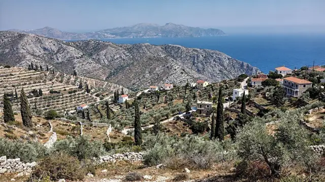
The north coast runs along the Sea of Crete, tied together by the VOAK / E75 highway, the island’s one genuine artery, linking Chania, Rethymno, Heraklion and Agios Nikolaos in a single afternoon’s drive. The south coast faces the Libyan Sea across a mountain spine — the White Mountains, Psiloritis, and the Lasithi range — and no equivalent highway crosses it. South-coast villages are strung along winding roads that climb over passes, or in a few cases, like Loutro and Agia Roumeli, are not reached by road at all.
That geography drives almost everything else in this comparison: how you get around, how warm the sea is on a windy week, what’s open in December, and how many people you’ll share a beach with.
Airports and Ferries: Where You Land Shapes Where You Start
Crete has three airports, and none of them sits on the south coast. Heraklion (HER) is the busiest, roughly in the middle of the north coast and close to Knossos and the resort strip toward Malia. Chania (CHQ), out at Souda, puts you within half an hour of the Venetian harbour and within reach of the Samaria trailhead. The small Sitia (JSH) airport serves the far east with limited scheduled traffic. Every one of the three lands you on the north, so even a trip planned around the Libyan Sea beaches usually starts with a mountain crossing rather than a direct arrival.
Ferries follow the same pattern. The overnight boats from Piraeus, roughly nine hours, dock at Heraklion or at Chania’s port of Souda, with further options at Rethymno, Agios Nikolaos and Sitia — every one on the north coast. Kissamos is the exception worth knowing, since its boats serve Kythira and Antikythira rather than the mainland.
There is no scheduled ferry service to the south coast at all: the boats that call at Loutro, Agia Roumeli, Sougia and Palaiochora are short coastal hops between those villages, not a way onto the island from outside it. See ferries from Piraeus, Heraklion airport and Chania airport for the specifics.
Getting Around: A Real Coach Network vs a Few Seasonal Runs
North of the mountains, KTEL coaches are a legitimate way to see Crete without a car. Services run regularly along the VOAK/E75 between Chania, Rethymno, Heraklion and Agios Nikolaos, with connections onward to Elounda, Malia and Sitia. It’s slower than driving, but reliable enough to build a whole trip around, and it’s worth reading a dedicated guide to KTEL buses before you assume it will cover every stop you want.
South of the mountains, that network largely disappears. A handful of seasonal KTEL routes reach Plakias, Chora Sfakion, Palaiochora and Ierapetra — often just once or twice a day, and thinner or suspended outside roughly May to October. Some places skip roads entirely: Loutro and Agia Roumeli are reached only by boat, and the coastal path between them is part of what keeps them that way.
| North coast | South coast | |
|---|---|---|
| Main road | VOAK/E75 highway, full length | No equivalent; winding secondary roads over passes |
| KTEL coaches | Frequent, year-round core routes | Sparse, mostly seasonal, some villages boat-only |
| Practical default | Car, coach, or a mix | Rental car close to essential |
| Comparison guide | Renting a car in Crete | Driving in Crete |
If a trip depends on public transport, that alone can decide the question — see rental car versus organised tours for how the two options actually compare on the ground, not just on paper.
The Meltemi: Why the South Gets Calmer When the North Gets Rough
In July and August, a strong north wind called the meltemi blows across the Aegean and straight into Crete’s north coast. It can cancel the boats to Balos, Imeri Gramvousa and Chrissi, kick up a chop along Platanias and Agia Marina, and turn an otherwise flat swim into a wind-whipped one. Anyone travelling in those two months should read what the meltemi does before booking a boat trip.
The south coast, sheltered by the Lefka Ori and Psiloritis, sees far less of it. The Libyan Sea stays warmer and calmer through the same weeks — one of the few reliable rules on an island where weather otherwise varies village to village. That’s a genuine argument for the south in high summer, not a marketing line: when Frangokastello or Sougia are glassy, the strip near Malia can be a washing machine.
Outside the meltemi months, the difference narrows. Spring and autumn sea temperatures run close on both coasts, and neither side has a monopoly on calm water in May or October.
Blue Flag Beaches and Organised Coast vs Wilder Coves
The north coast carries the island’s density of Blue Flag beaches — a European standard for water quality, safety and facilities. The strip from Platanias and Agia Marina through Rethymno’s town beach to Gouves, Hersonissos, Stalida and Malia is built around exactly that infrastructure: sunbeds, showers, lifeguards, easy parking. It suits families and anyone who wants predictability over discovery.
The south trades some of that polish for wilder coastline: pebble coves reached by dirt track, beaches with no facilities at all, and villages that feel more like endpoints than resorts. A day out from Ierapetra or Palaiochora can mean a near-empty stretch of sand with nothing but the sea and a taverna a walk away — see sunbeds and your rights on Cretan beaches for what Greek law actually guarantees wherever you land, organised or not.
Neither pattern is an upgrade on the other; they’re different products. If the point of the beach is the beach — clean water, easy access, sunbeds waiting — the north delivers it consistently. If the point is getting away from all of that, the south usually does the job better.
a private day exploring the south coast’s beach coves is one way to see that side without committing to a full rental-car itinerary, and a north-coast day combining a waterfall walk with an olive-oil tasting covers the equivalent ground up north.
Low Season: What Actually Stays Open
This is where the two coasts diverge hardest, and where a lot of trip planning goes wrong. From November to March, much of the south coast and the resort belt shuts down for winter — tavernas, hotels and boat operators alike, especially around Plakias, Palaiochora, Agia Galini and the smaller resort strips. The Samaria gorge closes for the season entirely.
The north’s three old towns don’t follow that pattern. Chania, Rethymno and Heraklion stay genuinely open year-round: museums, the Heraklion Archaeological Museum, the monasteries, and a working taverna scene that doesn’t depend on tourist volume the way a beach resort does. A winter trip to Crete is realistic if it’s built around the north’s towns and inland sites — it is not realistic if it assumes the south coast will behave the same way it does in July.
That contrast is worth planning around rather than discovering on arrival: a December trip to Palaiochora can mean a genuinely quiet, half-shuttered town, while the same week in Chania’s old harbour looks close to normal.
What Catches Visitors Off Guard
The north coast’s convenience has a cost in August: the VOAK/E75 through Gouves, Hersonissos and on to Stalida and Malia carries heavy traffic, and the beach strip that reads as organised in a brochure can feel closer to a resort corridor at midday in high season — packed sunbeds, queues for parking, music from three directions at once. Travellers expecting the quiet of a Greek island postcard sometimes find that stretch closer to a European package resort than to Crete itself, and end up wishing they had based a night or two further west around Platanias or in the Akrotiri peninsula instead.
The south’s charm has its own trade-off. Once the last coach or boat leaves, villages like Loutro, Sougia and Frangokastello go quiet fast — a handful of tavernas, no real nightlife, and dinner options that thin out considerably by October. Mobile signal drops in and out through the Samaria gorge, on the Imbros descent and along stretches of the mountain roads that link the south to everywhere else, so a plan that depends on booking things on the fly can stall exactly when there’s no wifi to fix it. Cash still matters here too: some of the smaller south-coast tavernas and boat operators don’t take cards, a detail that rarely shows up in the same glossy listing that sells the isolation.
Where Each Coast Actually Wins
Neither side is the correct answer for every trip, and the honest comparison depends on what the visit is for.
- Ease and infrastructure: the north, on the strength of the VOAK/E75 and KTEL, plus Blue Flag beaches and three lively old towns — see Chania vs Rethymno vs Heraklion for how those three compare directly.
- Calm water in high summer: the south, when the meltemi is running.
- A quieter, wilder feel: generally the south, though the far west of the north coast, around Kissamos and Falassarna, gets close.
- Winter travel: firmly the north’s towns; most of the south coast is not built for it.
- East-west decisions on top of this one: worth reading alongside east versus west Crete, since the north-south split and the east-west split answer different questions.
Multi-day trips that want both sides usually plan a loop: a few nights on the VOAK/E75 corridor, then a mountain crossing south. The south coast in six days and three days in the White Mountains and Sfakia itineraries both build that crossing in deliberately rather than as an afterthought.
a two-day 4x4 route linking the Lasithi highlands to the south coast is a practical way to make that crossing without driving it yourself, and a guided day into the south’s less-visited corners works well for a first look before deciding whether to base there longer. For a mountain day that touches both worlds, the Samaria gorge hike from the Omalos plateau down to the south coast ends exactly where the two sides meet, at Agia Roumeli.
Choosing a Side for a First Visit
For a first trip with three or four days, the arbitrage usually favours the north: land at Heraklion or Chania, and the coach network and short drive times mean less of the trip is spent on the road. A short list like Chania in 2 days or Heraklion in 2 days covers a lot of ground without a mountain crossing. With a week or more, the calculation flips: a night or two on the south coast, reached via the south coast in six days or Crete in seven days west to east, stops feeling like a detour and starts feeling like the point of the trip. Under three days, crossing the mountains just to sleep somewhere quieter rarely pays for itself — the drive alone can eat half a day each way.
North Coast or South Coast: Questions Travellers Actually Ask
Can I get around the south coast of Crete by bus?
Only partly. KTEL runs a handful of seasonal routes to towns like Plakias, Chora Sfakion, Palaiochora and Ierapetra, usually once or twice a day and often reduced or suspended outside May to October. Villages like Loutro have no road at all, so a rental car does not replace a boat there either.
Why is the south coast calmer in summer?
The meltemi is a strong north wind that peaks in July and August. It blows straight into the north coast and across the Aegean crossings to Balos, Gramvousa and Chrissi, while the Lefka Ori and the Psiloritis massif shelter the Libyan Sea side, so the south stays comparatively flat and swimmable.
Which coast has more Blue Flag beaches?
The north coast, by a clear margin. The organised beach strips from Platanias to Agia Marina, around Rethymno and along Gouves, Hersonissos, Stalida and Malia carry Blue Flag status often, backed by the VOAK/E75 road and a dense hotel base. The south has fewer flagged beaches and more unorganised coves.
Do south coast towns close in winter?
Many do. From November to March, a lot of south-coast and resort businesses shut for the season, and the Samaria gorge closes entirely. The three old towns of the north — Chania, Rethymno and Heraklion — stay open year-round, along with the main museums and monasteries.
Do I need a car for the south coast of Crete?
For most itineraries, yes. Outside the KTEL’s limited seasonal runs, a rental car is the only practical way to link south-coast villages, and even then some places, like Loutro and Agia Roumeli, have no road access at all — you arrive by boat or on foot.
Is the north coast worth visiting if I want quiet beaches?
It can still work if you choose carefully. The Akrotiri peninsula near Chania and stretches west of Falassarna are quieter than the Hersonissos-Malia strip, but for genuine isolation the south and the far west, around Elafonissi and Sougia, still have the edge.
Can I combine both coasts in one trip?
Yes, and most multi-day itineraries do. The north’s VOAK/E75 highway makes Chania, Rethymno, Heraklion and Agios Nikolaos an easy chain, and mountain roads or the E4 trail connect down to Plakias, Agia Galini, Palaiochora or Ierapetra in a few hours by car.
Which coast should first-time visitors choose?
For most first trips, the north makes the easier base: every airport and ferry port lands you there, the VOAK/E75 and KTEL coaches cover the main towns without a rental car, and Chania, Rethymno and Heraklion give three very different old towns within a day’s reach of each other. Add a south-coast night or two once the trip runs past about five days — Plakias, Palaiochora or Agia Galini are the easiest villages to reach without excessive driving.
Is mobile signal reliable on the south coast?
Not consistently. Coverage is fine in the bigger south-coast towns like Ierapetra and Agia Galini, but it drops in and out through the Samaria and Imbros gorges, on the mountain passes that connect the south to the VOAK/E75, and in some of the smaller boat-only villages. It’s worth downloading offline maps and confirming any south-coast booking before you set off, rather than counting on being able to sort it out from the road.
Top-Rated Crete Tours on GetYourGuide
Verified deep-linked GetYourGuide tours. Book through these links and we earn a small commission at no cost to you.
GetYourGuide does not provide a product photo for this activity — the image shows the meeting point, photographed by us.