The E4 Trail Across Crete: What a Realistic Traverse Looks Like
Can a non-mountaineer realistically hike the E4 trail across Crete?
Not as a casual undertaking. The E4 crosses terrain that climbs to Psiloritis at 2,456 m and Pachnes at 2,453 m, with snow lingering into May or June, and Crete has no train and only patchy KTEL bus coverage away from the north coast. A full west-to-east traverse suits experienced trekkers with real logistics planning, while most visitors are better served by single day hikes.
A Trail That Crosses a Small Island and a Big Mountain Range
The E4 is one of Europe’s long-distance paths, and its Cretan section is often described, a little too breezily, as a way to “walk across Crete.” On a map that sounds tidy: the island runs about 260 km from its western tip near Kissamos to its eastern edge past Sitia, and only 12 to 60 km from the north coast to the Libyan Sea in the south. Compared with a country-scale trail, that looks almost compact.
It isn’t. Crete packs three separate mountain ranges into that narrow footprint — the Lefka Ori, the White Mountains, in the west; the Psiloritis massif, also called Mount Ida, in the centre; and the Dikti range in the east. A route that tries to link them west to east has to climb and descend repeatedly rather than simply walk a coastline. This page exists to answer one honest question: is that a realistic project for a visitor who is not already an experienced mountain trekker? The short answer is no, not as a single continuous undertaking, and the rest of this guide explains why in terms of the island’s actual relief and transport, not a stage-by-stage itinerary we have not verified ourselves.
The Scale Problem: 260 km Long, but Never Flat
It helps to be specific about what “260 km” and “12 to 60 km wide” actually mean on the ground. Crete covers 8,336 km² and is home to roughly 620,000 people, spread across four regional units running west to east: Chania, Rethymno, Heraklion and Lasithi. A rental car can cover the island’s north coast corridor, Chania to Sitia, in a single long day, weather and traffic allowing. On foot, over mountain terrain, that same distance is an entirely different proposition.
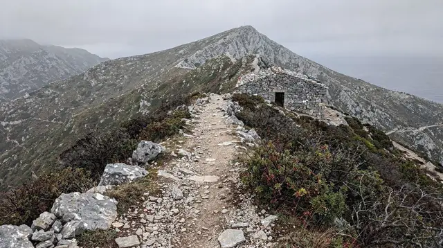
The reason is elevation, not distance. The island’s high point is Psiloritis, also known as Mount Ida, at 2,456 m, roughly in the centre of the island above Anogia. To its west, the Lefka Ori culminate at Pachnes, 2,453 m, barely lower. To the east, the Dikti range reaches 2,148 m above the Lasithi plateau. All three hold snow into May or, in a heavy year, into June. A route that links them does not follow a gentle contour; it repeatedly gains and loses well over a thousand metres, through terrain that shifts from Mediterranean scrubland at sea level to genuinely alpine conditions near the summits.
| Range | High point | Elevation | Region |
|---|---|---|---|
| Lefka Ori (White Mountains) | Pachnes | 2,453 m | West, above Chania and Sfakia |
| Psiloritis (Mount Ida) | Psiloritis | 2,456 m | Centre, above Anogia and Rethymno |
| Dikti | Dikti | 2,148 m | East, above the Lasithi plateau |
None of these are technical climbs requiring ropes, but all three demand the fitness, navigation sense and weather judgement of a genuine mountain trekker, not a casual walker on a week’s beach holiday who fancies a change of scene for a day.
Getting There and Back: Why Transport Decides More Than Fitness
Fitness is only half the constraint. The other half, and arguably the more limiting one for most visitors, is that Crete has no train anywhere on the island, and no ski lift on any of its snow-holding peaks despite the winter conditions up there. Every kilometre of a multi-day trail has to be reached and left on foot, by car, or by bus, and the bus network is not uniform across the island.
The KTEL coach network is genuinely usable along the north coast, linking Chania, Rethymno, Heraklion and Agios Nikolaos on the VOAK, also signed as the E75, the island’s main highway. If your itinerary keeps you near that corridor, getting to a trailhead and back to a hotel is straightforward. South of the mountains, and away from that same corridor, the picture changes: services thin out to a handful of seasonal runs, timed around specific villages and specific months, and they should never be assumed to exist without checking current timetables first.
| Area | KTEL bus reliability |
|---|---|
| North coast (Chania – Rethymno – Heraklion – Agios Nikolaos, via the VOAK) | Frequent, genuinely usable for day-to-day travel |
| South coast and mountain villages | Sparse, seasonal, a handful of runs a week at most |
| High mountain trailheads (Lefka Ori, Psiloritis, Dikti approaches) | Effectively none; a car or arranged transport is required |
That gap matters enormously for a west-to-east trail attempt. A trekker who finishes a day’s walking somewhere in the Lefka Ori or on the Psiloritis massif cannot assume a bus will be waiting to take them onward, or back to a car left at the start. Every leg of a multi-day crossing has to be planned with its own return logistics, worked out in advance, because the infrastructure that would otherwise absorb that problem — a train line, a dense rural bus grid — simply does not exist here.
This is also why mountain roads on Crete are narrow single-lane affairs where drivers pull onto the hard shoulder to let a faster car pass as a courtesy, not an invitation to overtake blind; the same roads that feed trailheads are not built for high traffic volume, which is part of why bus coverage stays thin.
What a Realistic Non-Mountaineer Trip Looks Like
Given the elevation and the transport picture, a full, self-supported, west-to-east crossing of the E4 belongs to experienced long-distance trekkers who plan their own resupply and their own return transport, ideally with a support vehicle or a pre-arranged shuttle for the sections south of the VOAK corridor. That is a legitimate and rewarding project for the right person.
It is not, however, something to fold into a standard one- or two-week Crete holiday, and this guide will not pretend otherwise by inventing a stage-by-stage schedule of huts, water points or daily distances we have not verified ourselves. Trail conditions, waymarking and any refuge or shelter along the route change from year to year, and a generic guide is the wrong place to state them as settled fact.
What is realistic, and genuinely rewarding, is picking one section that matches the time and fitness you actually have. A single day on Psiloritis, approached from Anogia, gives a real taste of the massif’s scale without committing to a traverse.
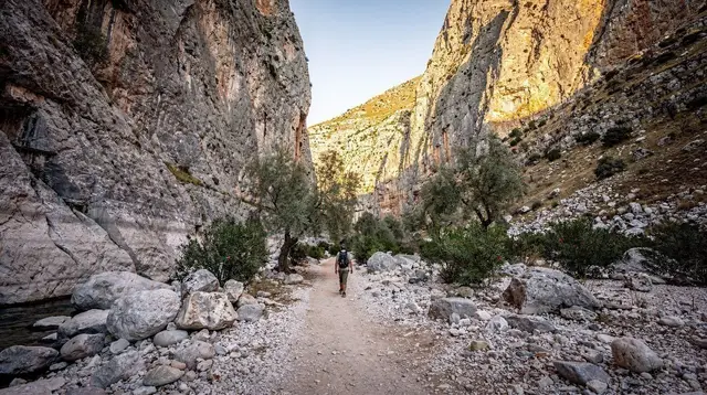
The gorges that thread through the Lefka Ori, including the well-known descent through Samaria from the Omalos plateau, or the shorter Imbros gorge nearby, offer a comparable sense of Crete’s mountain interior in a single day, with transport already built into an organised excursion rather than left for you to solve. In the east, canyon walks around Kavousi combine hiking with a swim, a much gentler introduction to the island’s relief for anyone travelling with less hiking experience or with a family.
a private guided trek up Mount Psiloritis with an experienced local guide is the closest most visitors should get to the high-mountain section of the E4 without independent trekking experience: it delivers the altitude and the views in a single, supported day, with transport handled for you.
For the gorge sections further west, a guided walk down the Samaria gorge from the Omalos plateau covers the same corner of the Lefka Ori that the E4 threads through, with the one-way logistics — bus in, boat out — already arranged rather than left to a solo hiker to solve.
If a full gorge day is more than you want, a shorter guided hike through the Imbros gorge gives a comparable mountain-and-ravine landscape in less time and with an easier profile, a sensible option for a first attempt at Cretan hiking terrain.
And for the eastern end of the island, where the Dikti range overlooks the Lasithi plateau, a guided canyon walk near Kavousi that finishes with a swim shows a gentler side of the same relief, useful context for anyone wondering how the E4’s character changes as it moves east.
Guided Alternatives to a Full Traverse
None of this means the E4 across Crete is a myth or a marketing invention. It is a real, mapped long-distance route, and parts of it are walked every season by trekkers who come specifically for the Lefka Ori or the Psiloritis massif. What this guide pushes back on is the framing of it as a walkable holiday activity, something a visitor could realistically string together across a week’s stay without prior mountain experience or a support vehicle. The island’s own numbers argue against that: a relief that runs from sea level to over 2,400 m in three separate ranges, snow that sits on those ranges into late spring, no rail network at all, and a bus system whose reliability effectively stops at the edge of the VOAK corridor.
Treat the E4 the way experienced trekkers already do: as a serious, standalone objective that deserves its own dedicated trip, its own season planning around the snowline, and its own transport arrangements worked out village by village. Treat your actual Crete holiday, by contrast, as an island of four distinct regions — Chania and the west, the south-west around Sfakia, Rethymno and its mountains, Heraklion and the centre, and Lasithi in the east — better explored through a mix of guided day hikes, driving, and the coastal gorges that don’t require you to solve the island’s transport gaps on your own.
Planning an E4 Attempt in Crete: Your Questions Answered
What exactly is the E4 trail in Crete?
The E4 is a European long-distance path, and its Crete section is meant to cross the island roughly west to east, tying together mountain ridges, gorges and villages rather than following a single easy track. It is not a resort-side nature trail; it runs through genuinely remote, high terrain.
How long is the E4 route across Crete?
Crete itself is about 260 km from west to east, and the E4 does not follow a straight line: it climbs over mountain ranges and drops into gorges, so its actual walking distance and the number of days it takes are considerably more than the island’s straight-line length suggests.
Do I need mountaineering experience to attempt the full traverse?
You need serious trekking experience at minimum. The route crosses the Lefka Ori, the Psiloritis massif and the Dikti range, terrain that holds snow into May or June, has abrupt weather changes, and offers few easy bail-out points. This is not a walk to improvise.
If I only want to walk one section, can I get back afterwards?
That depends entirely on where you are. The KTEL bus network is genuinely reliable along the north coast, between Chania, Rethymno, Heraklion and Agios Nikolaos on the VOAK highway. South of the mountains, and away from that corridor, services thin out to a handful of seasonal runs, so a return trip from a remote trailhead needs to be arranged before you set off, not after.
When is the safest time to attempt sections of the trail?
Snow lingers on Psiloritis, the Lefka Ori and Dikti into May or even June in a heavy year, which rules out an early-season high crossing. Most trekkers who take on the higher sections do so from June to September, but that is also when heat on the lower, exposed stretches becomes the limiting factor.
Are there guided alternatives to attempting the full traverse alone?
Yes. Guided single-day treks on Psiloritis, canyon walks with a fixed itinerary and transport included, and the well-established gorge hikes such as Samaria and Imbros give visitors a genuine taste of Crete’s mountain landscape without the logistics of a multi-day, self-supported crossing.
Is the E4 in Crete waymarked and maintained to a consistent standard?
Waymarking and maintenance vary by section and by year, and conditions on any given stretch are not something a general guide can responsibly summarise as fixed facts. Anyone planning to walk an unfamiliar section independently should confirm current status locally before relying on it, rather than following an assumed topo.
What is a realistic way for a first-time visitor to experience this landscape?
Pick a single well-defined day hike that matches your fitness, and treat the wider E4 as a long-term ambition rather than a holiday itinerary. Crete rewards that approach anyway, since the island is really four different regions strung along 260 km, and no single walk or single week covers it.
For a broader sense of what fits into a single trip, see how many days in Crete /guides/how-many-days-in-crete/ actually takes to cover the island properly, and how the /guides/crete-weather-month-by-month/ shapes what is realistic season by season. The snow that lingers on the high peaks is easiest to picture against the calendar in /guides/crete-in-may/ and /guides/crete-in-june/, the two months most likely to catch a trekker out.
For the western half of a possible crossing, the /destinations/anogia-psiloritis/ area is the usual approach to the Psiloritis massif, while the /guides/psiloritis-summit-hike/ and /guides/pachnes-and-the-white-mountains/ guides go into each peak on its own terms rather than as a single link in a longer chain.
The gorge sections that intersect the route are covered separately in /guides/samaria-gorge-complete-guide/ and /guides/imbros-gorge-guide/, both in the /destinations/samaria-gorge/ area of the south-west.
To the east, the /guides/dikteon-cave-birthplace-of-zeus/ and /guides/lasithi-plateau-day-loop/ guides cover the Dikti range’s best-known sites without requiring a mountain crossing to reach them. And because transport is the real constraint on any of this, read /guides/ktel-buses-in-crete/ and /guides/driving-in-crete/ before committing to any independent plan, and /guides/renting-a-car-in-crete/ if a car will be doing the logistical work that buses cannot.
For a structured week built around hiking rather than a single trail, /itineraries/crete-hiking-week/ and /itineraries/white-mountains-and-sfakia-3-days/ are a more realistic starting point than the full E4, and /guides/mistakes-to-avoid-in-crete/ is worth reading before any mountain plan, guided or independent.
Hiking Tours in Crete on GetYourGuide
Verified deep-linked GetYourGuide tours. Book through these links and we earn a small commission at no cost to you.
GetYourGuide does not provide a product photo for this activity — the image shows the meeting point, photographed by us.