Crete in Two Weeks: A Full-Island West-to-East Itinerary
Why west to east, and why fourteen days
Crete is 260 km long, and most itineraries either camp in one region and call it a holiday, or try to drive the whole island in a week and spend more time behind the wheel than on a beach. Fourteen days is the point where a west-to-east crossing becomes comfortable rather than a dash: five bases, no single driving day beyond about two and a half hours, and one deliberate rest base on the south coast where the only way in or out is a boat. If two weeks is more than you have, the 7-day west-to-east version compresses this same logic; if you have less structure in mind, how many days you actually need is worth reading first.
The rule this itinerary refuses to break: never more than about 90 minutes to two and a half hours of driving on a travel day, and never a Chania-to-Sitia jump in one sitting. That single 270 km, four-hour-plus drive is the mistake almost every rushed itinerary makes.
| Days | Base | Approx. drive to get there |
|---|---|---|
| 1-2 | Chania | Arrival |
| 3-5 | Loutro or Chora Sfakion | Day trips from Chania, then relocate |
| 6-8 | Rethymno | About 60 km / 1 hour from Chania |
| 9-11 | Heraklion | About 80 km / 1.5 hours from Rethymno |
| 12-14 | Agios Nikolaos or Ierapetra | About 65-95 km / 1-1.5 hours from Heraklion |
Day 1-2: Chania
Two nights in Chania is the right opening: enough time to walk the Venetian harbour without rushing, and a buffer against a delayed flight into Chania (CHQ) at Souda. Spend the first afternoon on the harbour and lighthouse, then the old town’s market streets on the second morning before the day heats up.
A short walking tour built around the harbour and the old Venetian fortifications is a good way to get oriented on arrival. a guided walk through Chania’s Venetian old town covers the harbour, the arsenals and the backstreets in a couple of hours, which leaves the rest of Day 2 free for the market and a slower lunch. Pick up the rental car on Day 2 afternoon so you are driving-ready for Day 3.
Day 3: Elafonissi
Elafonissi is about 76 km and two hours of mountain road from Chania, one way - budget most of the day, not a half-day trip. The pink tint is real but patchy, made of crushed foraminifera shells rather than the saturated pink of postcards, and the whole beach sits inside a Natura 2000 site where taking sand or shells is illegal and fined. Go early to beat both the heat on the drive and the midday coach traffic from Chania and Paleochora. Return to Chania for a third night, or push on toward Chora Sfakion if you would rather shorten Day 5’s relocation - either works, but staying in Chania keeps the Samaria logistics on Day 4 simpler.
Day 4: The Samaria gorge, start to finish
This is the one full day of the whole trip, and it should not be scheduled lightly. From Chania, transport (bus or organised tour) climbs to the Xyloskalo at Omalos, 1,227 m, where the gorge begins. From there it is 16 km one-way, entirely downhill in elevation but demanding underfoot, through the Samaria gorge to Agia Roumeli - a village with no road in or out. The narrowest point, the Iron Gates, is about 3-4 m wide beneath walls over 300 m high.
Once at Agia Roumeli, there is no driving out: a ferry runs to Chora Sfakion (the route this itinerary uses, since Day 5’s base is there), or to Sougia or Palaiochora, followed by a coach back toward Chania if needed. The park runs roughly May to October, closes for flood or fire risk without much notice, and gates shut in the early afternoon - start at first departure, not later.
an organised Samaria gorge day trip with transport and the exit boat included removes the logistics headache of matching bus times to ferry times on your own, which matters most on this specific day. For a shorter version of the walk from the bottom, the easy Samaria guide explains that 3-4 km there-and-back alternative, though it is not the route this itinerary follows.
Day 5: Loutro and Chora Sfakion
Wake up already on the south coast. Loutro has no road at all - access is by boat or on foot - while Chora Sfakion, a short hop away, has both a harbour and a car park, making it the practical base for this leg. Spend the day slowly: a swim off Loutro’s pebble coves, a walk toward Frangokastello’s empty Venetian fort along the coast, or a look at the Imbros gorge, a shorter and easier walk than Samaria for anyone whose legs are still tired from Day 4.
a boat trip along the Sfakia coast to Loutro and the Glyka Nera beaches is a low-effort way to see this stretch of coastline without driving, and a guided walk down the Aradena gorge to Loutro is the pick for travellers who want one more gorge without Samaria’s crowds or length.
Day 6: Rethymno
The relocation north to Rethymno is about 60 km from Chora Sfakion by the mountain road, or a longer loop back via Chania and the VOAK highway if the direct road feels tight for a rental car - either way, budget around 1.5 hours and arrive by early afternoon. Rethymno’s old town, wrapped around the Fortezza fortress, rewards an unhurried evening: narrow Venetian and Ottoman lanes, a working lighthouse on the old harbour, and tavernas that stay busy past 10pm in season.
Day 7: Plakias and Damnoni
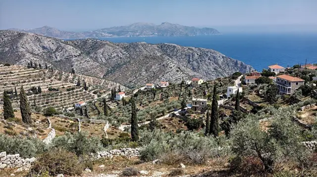
A short drive south over the mountains brings you to Plakias and Damnoni, Rethymno’s own stretch of the Libyan Sea coast - calmer and usually a few degrees warmer than the north coast, especially useful if the meltemi is blowing in July or August. This is also the access point for Preveli, whose palm gorge burned in 2010 and has regrown; the palm itself, Phoenix theophrasti, is endemic to Crete and the same species found at Vai on the island’s far east tip. a countryside jeep or off-road excursion through the villages above Plakias is a good use of an otherwise unstructured beach day if you want one active outing before the drive to Anogia.
Day 8: Anogia and Mount Psiloritis
From Rethymno, drive inland and up to Anogia, a mountain village under Psiloritis (Mount Ida), 2,456 m, the island’s highest point, which holds snow into May or June most years. Anogia itself is worth the detour independent of the mountain: it was destroyed in 1944 during the German occupation and rebuilt, and it remains a centre for Cretan weaving and lyra music rather than a tourist set piece.
a day spent with a Cretan shepherd family above Anogia is the most distinctive booking on this whole route - herding, cheese-making and a mountain lunch, a genuine look at the pastoral life the Psiloritis massif still supports. Return to Rethymno for the night, or press on to Heraklion if your Day 9 plans start early.
Day 9-10: Heraklion and Matala
The drive to Heraklion from Rethymno is about 80 km along the VOAK, roughly 1.5 hours. Give Day 9 to the Knossos Minoan palace in the morning, before the heat and the tour-bus peak - and note before you go that the vividly coloured frescoes on site are reconstructions; the originals are 5 km away in the Heraklion Archaeological Museum, which deserves the afternoon. A combined ticket covers both.
Day 10 heads south to Matala, about an hour from Heraklion, for its sandstone caves above a curved bay, with a stop at Phaistos, the Minoan palace whose still-undeciphered Phaistos Disc outshines Knossos in mystery if not in scale. Return to Heraklion for the night rather than adding a sixth base.
Day 11: The Lasithi plateau
East from Heraklion, climb to the Lasithi plateau at roughly 850 m. The thousands of white-sailed irrigation windmills that once covered the plateau are largely gone - what remains is rusted frames and a handful restored for photographs, not the postcard scene many expect. The Dikteon cave above the village of Psychro, the mythical birthplace of Zeus, is a steep and slippery descent, worth good shoes and a torch even with lighting installed. Continue east afterward to reach Agios Nikolaos by evening.
Day 12: Agios Nikolaos and Spinalonga
Base in Agios Nikolaos, on the gulf of Mirabello, and give the day to Elounda and Spinalonga. Spinalonga was a leper colony from 1903 to 1957, the last in Europe, built on a Venetian fortress island fortified in 1579 - it is recent history, not a scenic ruin, and the short walk around the settlement makes that clear. Boats run from Plaka, the shortest crossing, as well as from Elounda and Agios Nikolaos itself.
Day 13: Ierapetra and Chrissi
Relocate south to Ierapetra, about 35 km from Agios Nikolaos, for access to Chrissi, an uninhabited protected islet around 15 km offshore with a rare Juniperus macrocarpa forest. Boats run in season only and cancel in strong wind, so treat this as a weather-dependent day rather than a fixed booking - have Ierapetra’s own old town and waterfront as the fallback plan if the crossing is off.
Day 14: Sitia, Vai and Zakros
The final leg to Sitia is about 135 km from Heraklion if driving straight through, but from Ierapetra it is a shorter finishing stretch - keep it that way rather than looping back to Heraklion first. Sitia’s small airport (JSH) makes it a workable departure point if your flights allow it. Spend the last hours at Vai, the largest natural palm forest in Europe and fenced against camping, or extend to the Minoan palace ruins at Zakros if time allows before departure.
FAQ: planning the west-to-east crossing
Is two weeks enough to see all of Crete?
Two weeks covers the island honestly, from Chania to Sitia, but only if you accept one long day for the Samaria gorge and skip trying to add the far southwest villages of Sougia and Palaiochora on top. It is a full-island loop, not a leisurely single-region stay.
Can I do this route without changing hotels every night?
No, and you should not try. This plan uses five bases - Chania, Loutro or Chora Sfakion, Rethymno, Heraklion and Agios Nikolaos or Ierapetra - which keeps driving to two to three hours on travel days instead of packing and unpacking daily.
Do I need a 4x4 for this itinerary?
No. Every road on this route, including the Omalos plateau and the Lasithi plateau, is paved and manageable in a standard rental car. The only unpaved stretch worth naming, the Balos track, is not part of this itinerary.
Is it possible to drive from Chania to Sitia in one day?
It is roughly 270 km and over four hours without stops, and it wastes the point of visiting either end. This itinerary deliberately splits that distance across five bases so no single day exceeds about two and a half hours of driving.
What happens if the Samaria gorge is closed on my scheduled day?
The gorge closes for flood or fire risk with little notice, most often outside May to October. Build Day 4 with a flexible mindset: if it closes, Loutro, Chora Sfakion and the Imbros gorge on Day 5 absorb an extra day without reshuffling the whole trip.
Can I skip Elafonissi and save a day?
You can, and it is a reasonable cut if you have already done pink-sand beaches elsewhere. Folding that day into a longer stop in Chania or an extra night in Loutro works cleanly without breaking the west-to-east logic.
Will the boat to Chrissi or Spinalonga always run?
Neither is guaranteed. Chrissi’s seasonal boats from Ierapetra cancel in strong wind, and Spinalonga’s crossings from Plaka, Elounda or Agios Nikolaos can be affected by the meltemi in July and August. Keep those two days flexible rather than fixed.
Is this itinerary walkable for someone without a car?
Not as written - it depends on daily driving between bases that KTEL coaches do not fully cover, especially Loutro, Anogia and the Lasithi plateau. Travellers without a car should look at a north-coast-only version instead.
tours.14 days
Verified deep-linked GetYourGuide tours. Book through these links and we earn a small commission at no cost to you.
GetYourGuide does not provide a product photo for this activity — the image shows the meeting point, photographed by us.