Crete's South Coast in 6 Days: Plakias to Chora Sfakion
Why the Libyan Sea coast needs six days, not a loop
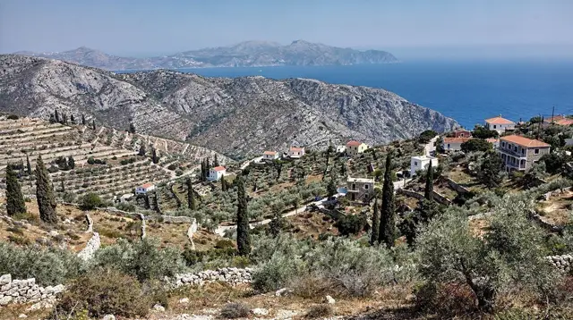
Crete’s south coast does not behave like the north. There is no single road running its length the way the VOAK / E75 links Chania, Rethymno, Heraklion and Agios Nikolaos. Instead the Libyan Sea is a series of bays, each reached by its own road down from the mountains, and the gaps between them are filled with gorges, cliffs and the White Mountains rather than tarmac. A trip that tries to treat this coast as one continuous drive ends up frustrated; a trip that accepts the geography ends up with six unhurried, different days.
This route runs west to east for its first five days — Plakias and Damnoni, Preveli, Agia Galini and Matala — then breaks the pattern on Day 6, doubling back through the interior to reach Loutro and Chora Sfakion, which sit further west again. That backtrack is not a design flaw.
It reflects the fact that no road connects Matala to Sfakia along the coast; the only way there is inland. Treat this itinerary as honest about that, rather than as a smooth east-to-west sweep, and the six days work well. It suits May to October: the Libyan Sea coast runs quieter than the north-coast resorts but a good number of its rooms, boats and tavernas close for winter, roughly November to March, so plan this trip outside that window.
A car is not optional on this route: buses reach Plakias, Agia Galini and Matala but not on a timetable that suits six moving days, and Loutro’s boat link only makes sense once a car has brought you to Chora Sfakion. Anyone renting for the first time in Crete should read the practicalities of renting a car in Crete before arrival, since insurance exclusions and one-way drop fees vary by agency, and the notes on driving in Crete cover the mountain-road habits — pulling onto the hard shoulder to let a faster car pass — that Days 3 and 6 both put to the test.
Day 1-2: Plakias and Damnoni
Plakias, on the south coast of the Rethymno regional unit, is the base for the first two days — a working fishing village turned low-key resort, with a long grey-sand beach and enough rooms and tavernas to make it comfortable without feeling built up. Damnoni, a short walk or drive east, is smaller and calmer, with clearer water and a more sheltered bay. Split the two days between them: swim in the mornings, walk the coastal path linking Plakias to Damnoni and on to Souda beach in the cooler hours, and use the second afternoon for something more active before the pace of the trip picks up on Day 3.
Plakias also sits close to the hill villages behind it, and one relaxed way to use an afternoon here is on horseback rather than on foot — a horse riding lesson through the countryside above Plakias covers ground a rental car cannot, at a pace that suits a first full day. Travellers who want a longer, guided walk instead can look at a guided walking tour of the paths around Plakias, which threads through the same hills from a different angle.
Damnoni’s clearer water also makes it one of the better spots on this stretch of coast for a first look underwater; the overview of snorkelling spots in Crete flags it alongside quieter coves further east, useful for deciding whether to pack a mask and fins for the whole trip or leave the gear behind.
Stay two nights in Plakias. It is the only base on this route with a genuine choice of rooms and restaurants, and every following stop is a day trip’s distance from it, so there is no benefit to rushing it into one night.
Day 3: Preveli and the Kourtaliotiko gorge
Preveli is roughly 14 km east of Plakias by road, but it holds enough for a full day on its own. Start at the Kourtaliotiko gorge, whose road drops sharply from the Rethymno-Plakias highway down towards the coast; a short walk from the roadside gives a view into the gorge without committing to a full descent. From there, continue to Preveli monastery, a working monastery with a dress code — covered shoulders and knees — and a small museum, before descending to Preveli palm beach itself.
The palm grove at Preveli is worth knowing the real story of before arriving. It burned in a 2010 wildfire and has regrown since; the palm is Phoenix theophrasti, a species found almost nowhere outside Crete, with its largest stand at Vai in the island’s far east. What visitors see today is recovery, not an untouched forest, and treating it that way makes the walk down to the beach more interesting rather than less. Reach the beach either on foot down a steep path or by the small boat that runs from the jetty in season.
Travellers who want the fuller picture before committing a whole day to it — opening hours, the state of the path down, and which of the two beach approaches suits them — should read the dedicated Preveli monastery and palm beach guide rather than relying on this itinerary’s overview alone.
For travellers who would rather have the gorge and the beach organised into one day without worrying about parking and timings, a guided day trip covering the Kourtaliotiko gorge and Preveli beach does exactly this route from a minibus, and a private version — the private Kourtaliotiko gorge, Preveli and Kalypso beach tour — adds a stop at the quieter Kalypso beach next door for groups who want their own schedule.
Return to Plakias for a third night, or push on to Agia Galini that evening if the day has run long — either works, since Agia Galini is a manageable onward drive either way.
Day 4: Agia Galini
Move base to Agia Galini, further east along the same stretch of the Libyan Sea coast. There is no direct coastal road from Preveli; the drive runs inland through Koxare and Akoumia before dropping back down to the water, roughly 30-35 km and well under an hour. Agia Galini itself is a small harbour town built into a hillside, with a working fishing fleet still visible alongside the tourist trade, and a beach that is functional rather than spectacular — it is the base for this stretch of coast, not the highlight.
Use the afternoon to settle in and walk the harbour, and treat the day as a deliberate pause between the more demanding days either side of it. Agia Galini also makes a workable base for a loop inland to Phaistos and Gortyna the following morning if time allows before continuing to Matala, since both sit on the Messara plain a short drive north.
Agia Galini disappoints travellers expecting another Plakias: the boats to Preveli and the day-trip traffic through the harbour keep the small beach busier than its size suggests, and rooms here are more functional than characterful. Readers still deciding how to split their base across the island can weigh it against the alternatives in where to stay in Crete before booking Days 3 and 4.
Day 5: Matala
Matala, on the Gulf of Messara, is a short onward drive from Agia Galini — under 30 km, mostly along the plain rather than over mountains, so this is the easiest transfer of the trip. Matala is known for the sandstone caves cut into the cliffs above its beach, used as tombs in antiquity and later, briefly, as informal shelter by 1960s travellers; today they are a fenced, ticketed site rather than somewhere to camp. The beach below is small and often busy by midday, so mornings are the better window.
Matala also sits close to the Messara plain’s Minoan and Roman sites — Phaistos was the second Minoan palace after Knossos, and Gortyna, not Knossos, was the Roman capital of the island — and either makes a good half-day addition if Day 4 was kept light.
For a wilder contrast to the caves and the crowds, the Agiofarago gorge south of the Messara plain drops to a small, isolated beach reachable only on foot; a guided hike through the Agiofarago gorge from Matala covers the walk down and back for travellers who would rather not navigate the dirt track and trailhead alone. Those who want Agia Galini and Matala tied together with a look at Rethymno’s old town on the way can also consider a day trip to Rethymno city from Agia Galini and Matala as an alternative use of this stretch of the trip.
Travellers who want more on the caves themselves — their history as tombs, then squats, then a fenced site — than this itinerary covers should read the Matala caves and Red Beach guide. Those who would rather turn Days 4 and 5 into a deeper Minoan and Roman detour than a single stop at Phaistos and Gortyna can look at Crete’s archaeology in 5 days as a variant of this route.
Day 6: Loutro and Chora Sfakion — via the interior, not a straight run
This is the day that breaks the pattern of the previous five, and it should be planned as such. Loutro and Chora Sfakion sit on the coast of the Sfakia region, west of Plakias and well west of Matala — but there is no coastal road connecting them to the Messara plain. The White Mountains and a run of gorges block any direct route along the shore. The only way to reach Sfakia from Matala is back inland: north across the Messara plain, then west and north again toward Rethymno, before turning south through Vrysses and down the mountain road, past the Imbros gorge, to Chora Sfakion. Budget roughly 2.5 to 3 hours of driving for this leg, more if stopping along the way, and treat it as a transfer day rather than a scenic add-on.
Chora Sfakion itself has road access; Loutro does not. The two villages are close by sea and by a coastal footpath, but Loutro is reached only by boat from Chora Sfakion or on foot, never by car — the same principle that shapes the whole south coast, distilled into one bay. Base in Chora Sfakion for the night, and take the short boat over to Loutro for a walk along its car-free waterfront and a swim.
For the fuller detail on Loutro itself — its handful of rooms, the paths in and out, and why nothing here is built for cars — see Loutro, the village with no road. Travellers who find they would rather spend three focused days on Sfakia and the White Mountains than fold it onto the end of a Libyan Sea coast trip can use White Mountains and Sfakia in 3 days as a standalone alternative to this final leg.
The Sfakia coast connects further west by the same small ferries that serve Agia Roumeli, the exit point for the Samaria gorge, and Sougia and Palaiochora beyond it — together they form the only real transport network along this part of the south coast, since the road stops at Chora Sfakion. Two guided options make the most of the day without needing to plan ferry timetables directly: a day trip to Glyka Nera beach, Loutro and Sfakia combines the boat-only beaches with Loutro itself, while the Aradena gorge and Loutro tour with optional pickup adds a walk down the dramatic Aradena gorge, which drops to the coast just above Loutro.
South coast at a glance
| Day | Base / stop | Distance from previous | Road type |
|---|---|---|---|
| 1-2 | Plakias and Damnoni | — (fly into Chania or Heraklion, drive south) | Mountain road from the north coast |
| 3 | Preveli (day trip from Plakias) | ~14 km each way | Winding coastal-hill road |
| 4 | Agia Galini | ~30-35 km | Inland via Koxare and Akoumia |
| 5 | Matala | ~25-30 km | Across the Messara plain |
| 6 | Chora Sfakion, with a boat to Loutro | ~140-160 km | Inland via Rethymno and Vrysses — no coastal road |
FAQs: driving the Libyan Sea coast in six days
Is there a coastal road along the whole south of Crete?
No. The Libyan Sea coast is a string of separate bays and villages linked by roads that climb inland through the mountains, not a continuous shoreline route. Plan driving times by the road you actually take, not the straight-line distance on a map.
Can this itinerary be done without a rental car?
Parts of it can, using KTEL coaches on the Rethymno-Plakias and Rethymno-Agia Galini-Matala lines, plus the seasonal boats between Chora Sfakion, Loutro and Agia Roumeli, but connections are thin and a car saves real time on Days 3 and 6.
Why does Day 6 go back through the interior instead of straight to Loutro?
There is no coastal road between Matala and Sfakia. The only way west is inland, typically via Rethymno and Vrysses to Chora Sfakion; Loutro itself has no road at all and is reached from there by boat or on foot.
When is the south coast best, and when does it shut down?
May to October is the working season. From November to March many south-coast tavernas, rooms and boats close for winter, so this six-day route is really a May-to-October plan.
Is the south coast better than the north when the meltemi blows?
Yes, generally. The meltemi is a summer north wind, and the Libyan Sea coast, being on the south side of the mountains, tends to stay calmer and warmer than Chania, Rethymno or Heraklion on the days it picks up.
Can I see Preveli’s palm beach and the Kourtaliotiko gorge in the same day?
Yes. The gorge road and the beach are close together on the same stretch of coast near Preveli monastery, and both are usually done as one day out of Plakias or on the way to Agia Galini.
Is Matala just the caves, or is there more to the base?
Matala’s caves and Red Beach are the draw, but the town sits on the wider Messara plain near Phaistos and Gortyna, so it also works as a base for a short detour inland before continuing the coastal route.
Does it matter whether I start this route from Chania or Heraklion?
Not fundamentally, but it changes the first day’s drive. Flying into Chania puts Plakias about ninety minutes away over the mountains, while flying into Heraklion makes it closer to three hours — in that case, starting the loop at Matala or Agia Galini and finishing in Plakias before the drive back to Chania airport can save some backtracking.
tours.6 days
Verified deep-linked GetYourGuide tours. Book through these links and we earn a small commission at no cost to you.
GetYourGuide does not provide a product photo for this activity — the image shows the meeting point, photographed by us.