Ierapetra and the Libyan Sea Coast
Why is Ierapetra's climate different from the rest of Crete?
Ierapetra sits on Crete's south coast, facing the Libyan Sea rather than the Aegean. The Dikti range and the island's spine of mountains block much of the meltemi, the strong north wind of July and August, so the sea here stays calmer and boats to Chrissi island keep running when north-coast crossings to Balos, Gramvousa or elsewhere are cancelled.
A different sea, a different coast
Most visitors picture Crete’s coastline as one long, wind-scoured shore, and for two-thirds of the island that picture is accurate. Chania, Rethymno, Heraklion and Agios Nikolaos all face the Aegean, on the island’s north side, where a strong seasonal wind called the meltemi can turn a flat morning sea into a grey, breaking chop by early afternoon. Ierapetra sits somewhere else entirely. It occupies the narrowest waist of Crete, where the island pinches down to only a few kilometres between its two coasts, and it looks south, over open water that has no other name on the map than the Libyan Sea — because the next landfall, roughly 300 km away, is the coast of Libya itself.
That orientation is not a minor detail. It is the reason Ierapetra’s weather, sea state and daily rhythm read differently from the resort towns most travellers already know from Gouves and Hersonissos or from Chania’s old town. The Dikti range and the broader spine of mountains running through the island’s centre stand between Ierapetra and the Aegean weather systems that shape the rest of Crete.
Wind that would be barrelling along the north coast at 6 or 7 on the Beaufort scale arrives in Ierapetra filtered, slowed, sometimes barely noticeable at all. Locals here talk about “the other side” the way sailors talk about weather they have learned to read: not as a curiosity, but as the fact that decides whether today is a boat day.
Why the meltemi passes Ierapetra by
The meltemi is a north wind that builds through July and August, occasionally starting in June and trailing into September, funnelling down the Aegean and hitting Crete’s northern and western shores directly. It is the reason boat trips to Balos and Imeri Gramvousa get cancelled with little warning in high summer, and it is strong enough to close small-boat crossings for days at a stretch. The wind does not vanish once it crosses the island — it loses altitude and force as it climbs and then descends the central mountains, and by the time whatever is left of it reaches the Libyan Sea, it has usually dropped enough that Ierapetra’s harbour stays workable.
This is the practical reason Ierapetra exists on so many south-coast itineraries as a base rather than a stopover: it offers a working alternative on exactly the days when the north coast does not. The table below sketches the pattern in broad terms — every season has exceptions, and a strong meltemi can still put a chop on the Libyan Sea — but the difference in reliability is real and it is why boat operators here talk about it openly.
| Coast | Typical July–August wind exposure | Boat trips during a strong meltemi |
|---|---|---|
| North coast (Chania, Rethymno, Heraklion, Agios Nikolaos) | Direct, can reach 6–7 Beaufort | Balos, Gramvousa and similar crossings frequently cancelled |
| Ierapetra, south coast | Buffered by the Dikti and central mountains | Chrissi crossings usually continue, sea state calmer |
None of this means Ierapetra is immune to bad weather — a sirocco blowing up from North Africa, or a deep low-pressure system, can still close the harbour — but day to day, through the hottest and windiest weeks of the Cretan summer, this stretch of coast behaves differently from the rest of the island. If a booked north-coast excursion falls through because of wind, a southern alternative from Ierapetra is often still running.
The gateway to Chrissi
The single reason most visitors come to Ierapetra is not the town itself but what lies about 15 km off its coast: Chrissi island, also known locally as Gaidouronisi. Chrissi is uninhabited, protected, and reachable only by boat — there is no bridge, no ferry car deck, and no private mooring for casual sailors.
It holds a rare cedar and juniper forest, sand dunes shaped by the sea rather than by any resort development, and a shoreline of pale, almost Caribbean-coloured water that has nothing to do with volcanic geology, since Crete has none, and everything to do with shallow limestone sand. Removing shells or sand from the islet is prohibited, there is no accommodation, and the small seasonal taverna near the jetty is the only infrastructure on the entire island.
Ierapetra’s harbour is the departure point. Boats run daily in season, and because the crossing sits on the sheltered Libyan Sea rather than the exposed Aegean, cancellations here are the exception rather than the rule that they can be at Balos or on the Piraeus ferry routes in a bad meltemi week. Several operators run the route as a simple return crossing, and others build it into a longer day on the water.
For travellers who want lunch included and a slower pace on board, a day cruise to Chrissi that serves lunch on the boat covers the crossing, several hours on the island, and the return without any logistics to arrange. A step up in comfort, a higher-end Chrissi cruise with drinks included runs a smaller group on a nicer boat, useful for anyone who finds a crowded ferry-style crossing takes the edge off a day meant for an empty beach.
It is worth being direct about what Chrissi is not: it is not a resort island, it has no ATM, limited shade outside a stand of junipers, and no shelter if the wind does pick up mid-afternoon, so a hat, water and a plan to be back at the jetty on time all matter more here than on a developed beach.
Not a base for the whole island
It is tempting, looking at a map of Crete, to imagine one hotel and day trips radiating out in every direction. The island does not work that way. Crete runs roughly 260 km from Chania in the west to Sitia in the east, and driving that distance takes more than four hours even without stops — Crete is not a small island that folds neatly around a single base. Ierapetra sits close to the eastern end of that line, in the regional unit of Lasithi, a genuine day’s drive from Chania and roughly ninety minutes to two hours from Heraklion depending on the route through the mountains.
That distance is precisely why Ierapetra deserves its own night or two rather than a rushed detour from a western base. Treating it as a same-day add-on from Chania means giving up most of the day to driving on both ends; treating it as the southern anchor of an east Crete itinerary alongside Agios Nikolaos, Elounda and Spinalonga, and Sitia lets the Chrissi crossing, the old town, and the villages inland all fit without a single rushed morning.
A three-day loop through Lasithi and the east is a realistic way to see this side of Crete properly, with renting a car the practical way to cover the ground between stops, since Crete has no train and the KTEL network thins out south of the mountains.
Walking the old town
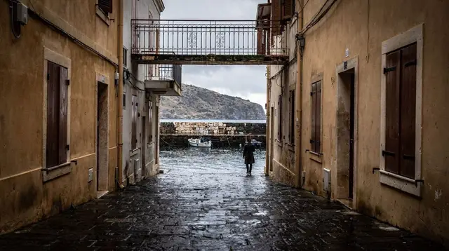
Ierapetra does not trade on postcard views the way Chania’s Venetian harbour does, and that is part of its character rather than a shortfall. This is a working town of roughly 12,000 people, Crete’s fourth largest, with a fishing fleet, a long promenade, and an economy built as much on the greenhouse agriculture visible on the plain around it as on tourism. The old quarter, known as Kales, sits around a small Venetian fortress on the harbour mouth, built to guard the port and rebuilt several times under Venetian and Ottoman rule. It is a modest structure compared with the walls of Heraklion or Rethymno’s Fortezza, and free to walk around outside, with the harbour and the open Libyan Sea as its backdrop.
A short walk inland from the fortress leads through narrow lanes to the town’s Ottoman-era mosque, its minaret restored and now a recognisable landmark on the skyline, and to a house identified by local tradition as the one where Napoleon Bonaparte spent a single night in 1798 while his fleet sheltered nearby en route to Egypt — a claim repeated more often than it is documented, but a fixture of how the town talks about itself.
Ierapetra’s small archaeological collection, housed in a former Venetian building near the centre, holds Minoan and Roman finds from the surrounding area, including a well-known Roman-era statue of the goddess Persephone, and gives useful context before or after a visit to the region’s bigger Minoan sites further west, such as Phaistos and Gortyna.
The long town beach runs east from the harbour, sand rather than pebble, backed by cafés and a paved promenade that fills with an evening volta, the slow walk-and-talk that is a fixture of Cretan town life rather than a tourist performance. It is a comfortable place to end a day, whether that day was spent on Chrissi or inland.
Beyond the town: day trips south and east
Ierapetra’s position at the base of the mountains makes it a natural starting point for trips that mix coast, gorge and village rather than beach alone. Inland and to the north, roads climb into the foothills toward villages and the Sarakina gorge, a shorter and less crowded walk than Samaria further west, with dramatic narrow walls and a manageable length that suits an afternoon rather than a full day. For travellers who would rather have a driver and a guide handle the route, a private tour through the inland villages and Sarakina gorge covers that ground without the need to navigate mountain roads solo.
East of Ierapetra, the coast opens toward Makrigialos and on to Sitia, with quieter beaches and small farming villages that see far fewer visitors than the Chania side of the island. West and north, the Lasithi plateau — the high, flat basin ringed by mountains where irrigation windmills once turned by the thousand — makes a full but rewarding day trip, climbing from sea level to around 850 m before descending back toward the coast.
For a single day that ties Ierapetra’s own history to the wider region without splitting a trip into several separate excursions, a guided day covering Ierapetra’s history and the southern coastline is built around exactly that combination, with a local guide handling the driving and the context.
Travellers based here for several days and curious about how the southern coast compares with the resort strip on the north shore often ask about Hersonissos, Malia and Stalida — the short answer is that Ierapetra shares almost nothing with them beyond being on the same island. There is no strip of nightlife bars here, no imported beach-club scene, and no crowd bussed in daily from package hotels; what Ierapetra offers instead is a genuine southern town, a calmer sea, and the easiest access on the island to Chrissi.
When to go and what to expect
The boat season to Chrissi runs roughly May to October, tightening at both ends depending on the year and closing outright in winter, when the islet’s fragile dune vegetation and its protected status mean no crossings are scheduled at all.
July and August bring the warmest water and the most reliable sailing conditions on this coast — precisely the months when the meltemi disrupts the north coast — but they also bring the highest temperatures and the busiest boats, so booking a morning departure ahead of time is worth doing rather than turning up at the harbour and hoping for space. Late May, June, September and early October offer a gentler balance: warm-enough water, thinner crowds on Chrissi’s beaches, and daytime temperatures in Ierapetra town that stay comfortable for walking rather than merely bearable.
Even outside the boat season, Ierapetra remains one of the mildest places on the island through the winter months, when the old town, the fortress and the harbour stay open and walkable while much of Crete’s south-west coast and its gorges close down entirely. That mildness is the same southern exposure at work in a different season — the same distance from the Aegean weather systems that keeps the summer sea calm also keeps the winter air gentler than it is on the north coast.
Practical Ierapetra
Ierapetra has no airport of its own; the nearest are Sitia (JSH), a small regional airport with limited seasonal flights, and Heraklion (HER), roughly 90 minutes to two hours away by road and the realistic arrival point for most visitors heading south.
KTEL coaches connect Ierapetra to Agios Nikolaos, Sitia and Heraklion on a workable if limited schedule, adequate for reaching the town itself and for the Chrissi boats, which leave directly from the harbour with no further transport needed. Exploring inland — the Sarakina gorge, the Lasithi plateau, the villages on the road toward Sitia — is far more flexible with a rental car, and the roads here, while mountainous in places, are less demanding than the narrow lanes of the south-west around Sfakia.
Ierapetra earns its place on a Crete itinerary on its own terms: not as a beach resort competing with the north coast’s package strip, and not as a rushed detour from a western base, but as the town that looks the other way — south, over a calmer sea, toward an island that most of Crete’s visitors never reach at all.
Ierapetra and Chrissi island: your questions answered
Why is Ierapetra’s climate different from the rest of Crete?
Ierapetra sits on the narrowest, southernmost stretch of Crete, looking out over the Libyan Sea. The Dikti mountains to its north absorb the meltemi, the strong seasonal wind that batters the Aegean-facing north coast in July and August, so Ierapetra stays noticeably calmer and often several degrees warmer.
Does the meltemi affect Ierapetra?
It affects Ierapetra far less than Chania, Rethymno or Heraklion. The meltemi blows from the north, and the mountains between the two coasts break its force before it reaches the Libyan Sea, so boats from Ierapetra to Chrissi island generally keep sailing on days when north-coast excursions are grounded.
How do I get to Chrissi island from Ierapetra?
Small passenger boats leave Ierapetra’s harbour for Chrissi in season, a crossing of roughly 45 minutes to an hour each way. There is no accommodation on the islet, no shop beyond a small seasonal taverna, and no jetty for private boats, so a scheduled crossing or a booked cruise is the only practical way there.
How far is Ierapetra from Chania?
Around 270 km and more than four hours of driving, most of it on the north-coast highway before cutting south through the mountains. Crete is not a small island with one convenient base, and Ierapetra belongs to a separate, southern leg of any itinerary rather than a day trip from the west.
Is Ierapetra a beach resort town?
Not in the Hersonissos or Malia sense. Ierapetra is a working southern town with its own fishing fleet, greenhouse agriculture and a genuine old quarter, with a long town beach and easy access to Chrissi rather than an imported strip of resort hotels.
What is there to see in Ierapetra’s old town?
A small Venetian fortress on the harbour, a Kales quarter of narrow lanes, the Ottoman-era mosque with its restored minaret, the so-called House of Napoleon, and an archaeological collection housed in a former Venetian building, all walkable in a couple of hours.
When is the best time to visit Ierapetra?
May to October for Chrissi boat trips and swimming, with June, September and early October giving warm water and thinner crowds. Ierapetra’s winters are among the mildest on the island, so its old town and seafront stay pleasant for a walk even in the low season.
Can I visit Ierapetra without a car?
The KTEL coach network reaches Ierapetra from Agios Nikolaos, Sitia and Heraklion, and the town itself is entirely walkable. Reaching Chrissi needs no car at all, since the boats leave directly from the harbour, but exploring inland villages and gorges around Ierapetra is far easier with one.
City Walking Tours in Crete on GetYourGuide
Verified deep-linked GetYourGuide tours. Book through these links and we earn a small commission at no cost to you.
GetYourGuide does not provide a product photo for this activity — the image shows the meeting point, photographed by us.