Photography Spots in Crete: Light, Landscape and Limits
Where should photographers go in Crete?
The strongest images come from limestone landscapes, not volcanic ones: the snow-capped peaks of the Lefka Ori and Psiloritis, the Venetian fortress on Spinalonga, the Samaria and Imbros gorges, and the coastline at Balos and Elafonissi. There is no caldera or lava anywhere on the island, and the famous pink at Elafonissi is subtle, not saturated.
Start With What Crete Is Not
The single fastest way to plan a photography trip to Crete is to drop the wrong reference points first. This is not a volcanic island: there is no caldera, no fumarole, no lava field and no black-sand crater rim anywhere on it. Crete is limestone, folded and lifted, then cut by some of the deepest gorges in Europe.
If the picture in your head is Santorini’s caldera at sunset, recalibrate - the drama in Crete comes from mountains that hold snow into early summer, a coastline shaped by centuries of Venetian and Ottoman rule, and gorges narrow enough that the sky becomes a thin white line overhead. Once that expectation is reset, the island’s real strengths - scale, geology and layered history - become much easier to plan around, and much easier to photograph honestly.
The second expectation worth dropping is guaranteed colour. Crete is roughly 260 km long, crosses four regional units, and its light changes with altitude, coastline orientation and season in ways a single itinerary cannot promise to deliver on cue. What follows is a region-by-region guide to where the images are genuinely strong, paired with the practical limits - insurance, protected status, opening hours - that shape whether you can act on them on any given day.
The blog post Crete Is Not a Small Island makes the same planning point at greater length, and Gortyna, Not Knossos, Was the Roman Capital is a reminder that even the island’s best-known ruin is often mis-attributed by visitors working from memory alone.
Mountains That Hold Snow Into Summer
Crete’s high country is the clearest antidote to the volcanic-island image. The island’s highest point, Psiloritis (also called Mount Ida) at 2,456 m, and Pachnes in the Lefka Ori, the White Mountains, at 2,453 m, both carry snow into May or June most years, with Dikti at 2,148 m not far behind.
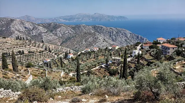
That produces a genuinely unusual frame in the eastern Mediterranean: white peaks above olive terraces and, from the right vantage point, a sea that is already blue and warm for the season. The village of Anogia, set on the slopes of Psiloritis, is a reasonable base for anyone wanting the mountain in frame without committing to a summit attempt - see Anogia and Mount Psiloritis for the practicalities, and Psiloritis Summit Hike: How Long It Really Takes if a hike to the top is part of the plan.
For a wider view of the same ridgeline without the climb, Scenic Flights and Paragliding Over Crete covers the handful of operators offering aerial passes over the peaks, conditions permitting.
The White Mountains reward a different kind of patience. Long-range views from the Chania plain, from Therisso, or from elevated points along the Samaria approach road change hour to hour as cloud builds and clears over the ridgeline. Pachnes and the White Mountains covers routes into the range itself; for context on how the mountains sit above the gorge country, Souda and Akrotiri: Beyond the Ferry Port gives a lower, easier vantage a short drive from Chania.
Further east, the Lasithi plateau sits at around 850 m, ringed by peaks and dotted with the rusted frames of what were once thousands of white-sailed irrigation windmills - almost all gone now, a handful restored, most simply skeletal. It is a landscape worth photographing for what remains rather than what the old postcards promised. Lasithi Plateau and A One-Day Loop Around the Lasithi Plateau cover the loop road around the plateau; the Dikteon cave at Psychro, the mythical birthplace of Zeus, adds a steep, slippery descent into darkness that rewards a tripod and patience - see The Dikteon Cave and the Lasithi Plateau, Before You Descend.
The high ridgelines are not only rock and snow. The Lefka Ori still hold a small population of bearded vultures, spotted more often at dawn before the thermals have built up - The Bearded Vultures of the White Mountains covers where sightings cluster and why a long lens matters more than proximity. Lower down, the window for wildflowers running through the foothills and gorge entrances is short and season-dependent: April and May carry the widest bloom, tailing off fast once the summer heat sets in, and Wildflowers and Herbs Around Spili and the Psiloritis Foothills has the month-by-month detail worth checking before booking a spring trip built around it.
Crete in May: Weather, Crowds and What to Expect narrows the calendar further: it is often the one month that still shows snow on the summits while the wildflower bloom is at its widest.
For the exact month-by-month odds of catching snow on the peaks, Crete Weather Month by Month breaks down the shift from the spring thaw to the first autumn dustings, and the blog post Snow in Crete explains why a summit shoot still needs a spring backup date rather than a single fixed booking.
Gorges: Crete’s Real Geological Drama
Where a volcanic island offers a crater, Crete offers gorges, and the Samaria gorge is the headline example: 16 km one-way from the Xyloskalo at Omalos, 1,227 m up, down to Agia Roumeli, a village with no road out. The narrowest point, the Iron Gates, is roughly 3-4 m wide beneath walls over 300 m high - a genuinely rare frame, though a phone camera struggles more than a wide lens does in that confined light.
The gorge is open roughly May to October, gates close in the early afternoon, and the only way out of Agia Roumeli is by boat to Chora Sfakion, Sougia or Palaiochora, then a coach back. Full route planning lives at The Samaria Gorge: A Complete Guide and Samaria Gorge from Chania: The Complete One-Way Hike; a shorter option that avoids the full descent is The ‘Easy Samaria’ Walk from Agia Roumeli, Explained.
The Imbros gorge, closer to Chora Sfakion, is narrower in places and less crowded, and pairs well with a stop at Frangokastello and the Imbros Gorge for its flat coastal fortress light. See Imbros Gorge: The Practical Guide to Crete’s Other Canyon. For anyone building a wider south-coast circuit, Loutro and Chora Sfakion covers the boat-only village of Loutro, reachable only on foot or by sea, which gives a genuinely different coastal frame from anything on the north side of the island.
Two lesser-known gorges reward photographers willing to walk further for a quieter frame. Richtis Gorge and Its Waterfall: Crete’s Quiet Far-East Hike in the east ends at a waterfall and a pebble beach with almost none of Samaria’s crowds, while the coves at Seitan Limania and the Akrotiri Coves: How to Reach Them, cut into pale cliffs on the Akrotiri peninsula, give a turquoise-on-white contrast close enough to Chania for a half-day out and back. On the south coast, the boat-only beaches covered at Glyka Nera and the Sfakia Beaches sit beyond any road, reachable only from Chora Sfakion or Loutro, which keeps them close to empty even in August.
Photographers who want to get inside the rock rather than only walk between its walls can look at Climbing and Canyoning in Crete, which covers the handful of Cretan canyons set up for guided descents.
Photographers building a longer trip around gorge light rather than a single descent can string several routes together with Crete Hiking Week, which sequences Samaria and Imbros alongside quieter walks such as Agia Irini Gorge across a full week.
Balos, Gramvousa and the Insurance Problem
The turquoise lagoon at Balos, in the far west, is one of the most photographed views in Crete, and one of the most misunderstood logistically. The approach road is a dirt track of roughly 8 km followed by a 20-30 minute walk down to the lagoon and back up. Most rental car contracts specifically exclude unpaved roads from their coverage, which means a breakdown or a scrape on that track is, in practical terms, uninsured.
The boat from Kissamos sidesteps the entire problem: it also calls at Imeri Gramvousa, an islet crowned by a Venetian fortress dating to 1579, which gives a second strong subject - fortified stone against open water - in the same outing. Route planning for both approaches is at Balos Lagoon: Boat or Dirt Road? and Imeri Gramvousa: A Venetian Fortress on a Desert Islet; the destination overview is at Balos and Gramvousa.
The departure town itself, covered at Kissamos and Kissamos: Crete’s Gateway to Balos and Gramvousa, is worth an hour before or after the crossing rather than treated as a car park.
Nearby, Falassarna offers a wide, west-facing sand beach that catches sunset light with none of the access complications of Balos - see Falassarna Sunset Beach: Is It Really Crete’s Best? for orientation, and Sunset Cruises in Crete if a boat rather than a headland is the preferred vantage point.
The blog post The Balos Road and Your Rental Insurance goes further into what a typical rental contract actually excludes, for anyone still weighing the drive against the boat.
Elafonissi: Subtle Pink, Strict Rules
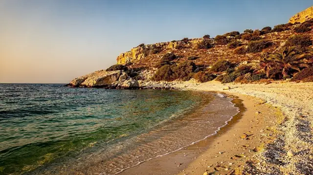
Elafonissi, at the far south-west corner, is the other image most visitors arrive expecting to match exactly - and the one most likely to disappoint if the expectation is a saturated, uniformly pink beach. The colour is real, produced by crushed foraminifera shells mixed into the sand, but it is patchy, concentrated in the wet tide line, and considerably softer in person than in colour-adjusted photographs online. Elafonissi is also a Natura 2000 protected site, and removing sand or shells - even a handful for a jar, even for a photograph - is illegal and fined.
The honest approach is to photograph the shoreline as it is: pale sand shading into a faint rose where the shallow lagoon meets the beach, with the shallow, warm-toned water itself often doing more visual work than the sand does. It is about 76 km and two hours of mountain road from Chania, so plan the drive as part of the day rather than an afterthought. See Elafonissi Beach: The Truth About the Pink Sand and Elafonissi for the practical detail.
Topolia and the Elos Chestnut Villages breaks up that drive with a gorge village worth a short stop, rather than treating the road as a straight run to the coast.
a day excursion to Elafonissi’s pink-sand beach covers the drive and gives a fixed return time, which matters on a coast where the light changes fast and a self-drive day can easily run long.
For a side-by-side comparison of colour, crowds and access, Balos vs Elafonissi is worth reading before settling on just one beach, and the blog post The Truth About Elafonissi’s Pink Sand goes deeper into why online photos oversell the colour.
Spinalonga: Fortress, Not Just Scenery
The Venetian fortress island of Spinalonga, in the gulf of Mirabello near Elounda, is one of the strongest man-made subjects on the island: walls dating to 1579, narrow lanes, and a silhouette that reads clearly from the water on the approach. It is worth remembering, before framing a shot, that this was a leper colony from 1903 to 1957, the last in Europe - recent history for many Cretan families, not backdrop. Boats run from Plaka, the shortest crossing, as well as from Elounda and Agios Nikolaos. See Spinalonga: The Fortress That Was Never a Film Set and Spinalonga: Which Boat Should You Take? for the practical comparison.
Elounda and Spinalonga has the wider context, including Kritsa’s hillside setting a short drive away at Kritsa and Neapoli: Lasithi’s Inland Villages.
Agios Nikolaos: Base for Lasithi and Spinalonga and Agios Nikolaos and Lake Voulismeni: A Walking Base for Spinalonga cover the town most visitors base themselves in for the crossing, built around a small lake that photographs well on its own.
The blog post Spinalonga Within Living Memory is worth reading before a shoot there, since it draws on accounts from people who actually lived on the island.
Light Across a Day: Old Towns and the Coast
Away from the marquee landscapes, Crete’s three old towns give reliable, repeatable light. The Venetian harbour in Chania, with its lighthouse and the Firkas fortress, works well in the early morning before the waterfront fills; see Chania’s Venetian Harbour and Lighthouse and A Walk Through Chania’s Old Town. Rethymno’s old town and its Fortezza hilltop fortification catch a similar low, warm light in late afternoon - Rethymno’s Fortezza: A Fortress Built for Siege.
Chania Market and Food Streets: Reading the Old Town’s Food Scene covers the covered market a few minutes inland from the harbour, useful at midday when the waterfront light goes flat. Rethymno Old Town: A Walk Through Two Empires covers the streets below the Fortezza, worth the same visit rather than the fortress alone.
Heraklion is less obviously photogenic at street level, but the Venetian walls where Nikos Kazantzakis is buried, and the Heraklion Archaeological Museum, which holds the original Minoan frescoes - the ones on display at Knossos itself are replicas - are worth building into a city walk; see Heraklion Archaeological Museum: The Originals Knossos Doesn’t Have and Knossos and the Heraklion Archaeological Museum.
Knossos Palace: The Complete Visitor’s Guide is worth reading before going, since the site has almost no shade and a summer visit belongs at opening time rather than midday. Phaistos and Gortyna: The Messara’s Two Ruins covers a quieter Minoan site south of the city, with none of Knossos’s crowds.
For a wider single-day landscape circuit that mixes mountain, lake and gorge light without committing to a multi-day drive, Lake Kournas & Argyroupoli and Therisso Gorge and the White Mountain Villages South of Chania both sit within reach of Chania and Rethymno.
a sunset safari across Crete’s back roads is a practical way to reach several elevated viewpoints in one evening without needing to plan the driving and timing yourself, which matters when the light window is short.
Anyone deciding which old town to prioritise for a short stay can compare them directly in Chania vs Rethymno vs Heraklion, which weighs light, crowds and how well each town works as a base.
Building a Photography Day Around the Terrain
Because Crete is not one destination but four - Chania and the west, the south-west gorges, Rethymno and its mountains, and Heraklion and Lasithi to the east - a single base rarely covers more than one of these zones well in a day. Chania to Sitia is roughly 270 km and over four hours, so a realistic plan groups locations by region rather than by a wish list spread across the whole island.
| Region | Strongest subjects | Practical note |
|---|---|---|
| Chania and the west | Balos lagoon, Imeri Gramvousa fortress, Falassarna sunset | Balos road excluded from most rental insurance |
| South-west | Samaria and Imbros gorges, Loutro | Samaria open roughly May-October only |
| Rethymno and mountains | Psiloritis snow line, Arkadi monastery | Snow visible into May or June most years |
| Heraklion and centre | Heraklion museum frescoes, Venetian walls | Knossos originals are in the museum, not on site |
| Lasithi and the east | Lasithi plateau, Spinalonga fortress | Boats to Spinalonga run from three departure points |
If only half a day is available on a stopover, skip the multi-hour drives entirely: A Walking Guide to Heraklion’s Old Town and the Venetian fortifications at Koules Fortress and the Venetian Walls of Heraklion sit within walking distance of the port and the museum, and cover most of the city’s strongest frames without a rental car at all.
A Land Rover route through the back country covers several of the western viewpoints - Balos overlooks, Kissamos backroads, the fringe of the Lefka Ori - in a single day without the insurance question that a self-driven dirt track raises. a full-day Land Rover tour through Crete’s back roads is built for exactly that kind of ground.
For the quieter south coast - Plakias, Damnoni, Preveli’s palm gorge, and beaches with no resort development behind them - a private tour of Crete’s south coast beaches gives a fixed route without the long solo drive over the mountain passes that separate the south coast from the north.
For anyone unsure how many days the whole circuit actually needs, How Many Days in Crete and the region-by-region route at Crete in 7 Days: West to East both size the trip around the terrain rather than a wish list.
Away From the Coast: Villages and Working Landscapes
Not every strong image in Crete is a landscape. The pottery village of Margarites and the Melidoni Cave still has working workshops, and the wine villages around Archanes and the Dafnes Wine Country - Archanes, Dafnes and Peza - offer close, textured subjects: old vine rows, stone cellars, and harvest activity depending on season. See Cretan Wine Grapes: What Is Actually in the Glass and Peza and Archanes: A Day With Crete’s Own Wine Grapes for context on timing a visit around harvest rather than arriving blind.
a wine and olive oil tasting in Crete’s vineyard country is a low-key way to spend an afternoon among exactly this kind of working landscape, useful when the midday sun is too flat for coastal or mountain shots and a shaded courtyard is the better option.
For a more active add-on that reaches viewpoints a standard road route does not, a quad safari through Crete’s back country covers tracks between villages that a rental car would struggle with, though as with Balos, check what your own travel insurance - not the vehicle rental - actually covers before booking.
The blog post Buying Olive Oil That Is Actually Cretan is a useful companion for anyone photographing the mills and groves rather than just the bottles on a shelf afterwards.
Palms, Caves and Islets Further Afield
Further material worth building a day around sits outside the marquee landscapes above. The palm gorge at Preveli and the Kourtaliotiko Gorge, which burned in 2010 and has regrown, ends at a beach reached on foot or by a small boat from Plakias - see Preveli Monastery and Palm Beach for the route. Further east, Vai Palm Beach: Europe’s Largest Natural Palm Forest and Sitia, Vai and Zakros: Crete’s Far East cover the largest natural palm forest in Europe, the same endemic species as at Preveli, backed by dunes rather than cliffs.
On the north coast, the sea caves and red-tinted rock at Matala: Caves, Red Beach and the Messara Coast near Matala give a different texture again, closer to Heraklion than any of the west-coast subjects. Offshore, Dia Island Boat Trips: Kri-Kri, Not Dolphins reaches Dia Island, Heraklion’s Uninhabited Offshore Refuge, one of the last refuges of the kri-kri, the Cretan wild goat - Wildlife in Crete: Kri-Kri, Snakes and Vultures has the detail on where the animals are actually visible rather than merely rumoured.
Why I Stopped Worrying About Snakes in Crete’s Gorges is worth knowing before scrambling off-trail for a shot - the island has four snake species and no vipers.
Inland, the blast site covered at Arkadi Monastery: Crete’s National Symbol of 1866, the monastery of Arkadi Monastery where hundreds died in 1866, carries a dress code and a weight that no amount of good light should paper over.
The blog post Preveli Burned in 2010 and Grew Back has more on the fire and the regrowth for anyone framing the palms as more than scenery, and Toplou Monastery and Vai pairs the fortified monastery with the palm beach for a single eastern day out.
Practical Notes Before You Pack a Camera Bag
A few practical points sit outside the geography. Best Time to Visit Crete: Why July and August Aren’t the Whole Story and the month-by-month detail behind it matter more for photography than for a beach holiday, since haze, wind and crowd levels shift the same view considerably between May and September. What to Pack for Crete covers gear-adjacent basics - a lens cloth for salt spray, a headlamp for cave and pre-dawn starts - worth checking before a first Crete trip.
Driving in Crete: Do You Really Need a Rental Car? covers the mountain roads and hard-shoulder etiquette that shape how long a cross-island day actually takes, and Private Tours and Drivers in Crete is worth knowing about for anyone who would rather watch the light than the road.
On the beach itself, Sunbeds and Your Rights on Cretan Beaches explains the legal requirement for a free, sunbed-free corridor to the water, which is often the cleanest unobstructed frame going. And before setting an itinerary, Common Mistakes to Avoid in Crete collects the planning errors - including underestimating drive times between regions - that cost photographers the most shooting time.
Photographers travelling with mobility constraints should check Accessible Crete before committing to gorge or cave locations, several of which involve steep, uneven ground with no easy alternative route.
What Nobody Can Promise You
No operator, however good, can promise a specific colour, a clear summit or a calm sea on a fixed date. The meltemi, a strong north wind that blows mainly in July and August, regularly cancels the boat crossings to Balos, Gramvousa and Chrissi while leaving the south coast, on the Libyan Sea, calm - which is one more reason a west-to-east or north-to-south itinerary built around a single fixed day can fail on exactly the day that matters most. The honest plan for a photography trip to Crete is to build in slack: a spare afternoon, a second route to the same viewpoint, and no single irreplaceable shot resting on one weather forecast six weeks out.
What the Meltemi Does to Your Holiday goes further into what the wind changes beyond the boat schedules, for anyone building a trip around a single forecast.
Photography Spots in Crete: Questions Worth Settling Before You Go
Is Crete a volcanic island like Santorini?
No. Crete sits on folded limestone, not a volcanic caldera. There is no lava, no fumarole and no thermal pool anywhere on the island - the drama here comes from gorges, cliffs and high mountains, not volcanic rock.
Can I collect sand or shells at Elafonissi for a photo?
No. Elafonissi is a protected Natura 2000 site, and removing sand, shells or foraminifera - the tiny organisms that tint the shore pink - is illegal and fined. Photograph what is there and leave it in place.
Is the pink sand at Elafonissi as saturated as it looks online?
Rarely. The colour is real but patchy and shifts with light, wind and the tide line. Many widely shared images are colour-boosted; expect a soft blush in the wet sand rather than a uniform pink beach.
Can I drive to Balos for photos?
You can, but the final approach is an unpaved dirt track of about 8 km, and most rental car contracts exclude unpaved roads from their insurance. A breakdown or a scrape there is not covered. The boat from Kissamos, which also stops at the Venetian fortress on Imeri Gramvousa, avoids the issue entirely.
When do the mountains have snow for photos?
Psiloritis at 2,456 m and Pachnes in the Lefka Ori at 2,453 m typically hold snow into May or June, giving a rare combination of snow-capped peaks above a sea that is already warming up for summer.
Is Spinalonga worth photographing beyond the fortress walls?
Yes, but treat it as a former leper colony, not only scenery - people lived there until 1957. The 1579 Venetian fortifications, the narrow lanes and the view back to Elounda across the gulf of Mirabello are the strongest frames; boats run from Plaka, Elounda and Agios Nikolaos.
Does anyone guarantee good light or colour on a shoot in Crete?
No responsible operator does. Light depends on season, weather and the meltemi wind, which can cancel boat trips to Balos, Gramvousa and Chrissi in July and August. Build in a spare day rather than expecting a single date to deliver.
Photo Tours in Crete on GetYourGuide
Verified deep-linked GetYourGuide tours. Book through these links and we earn a small commission at no cost to you.
GetYourGuide does not provide a product photo for this activity — the image shows the meeting point, photographed by us.